dardenne creek blueway out and back , mo Overall FKP Details
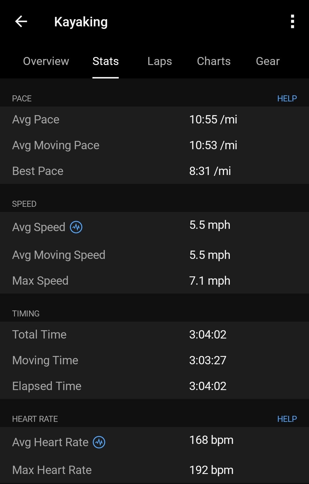
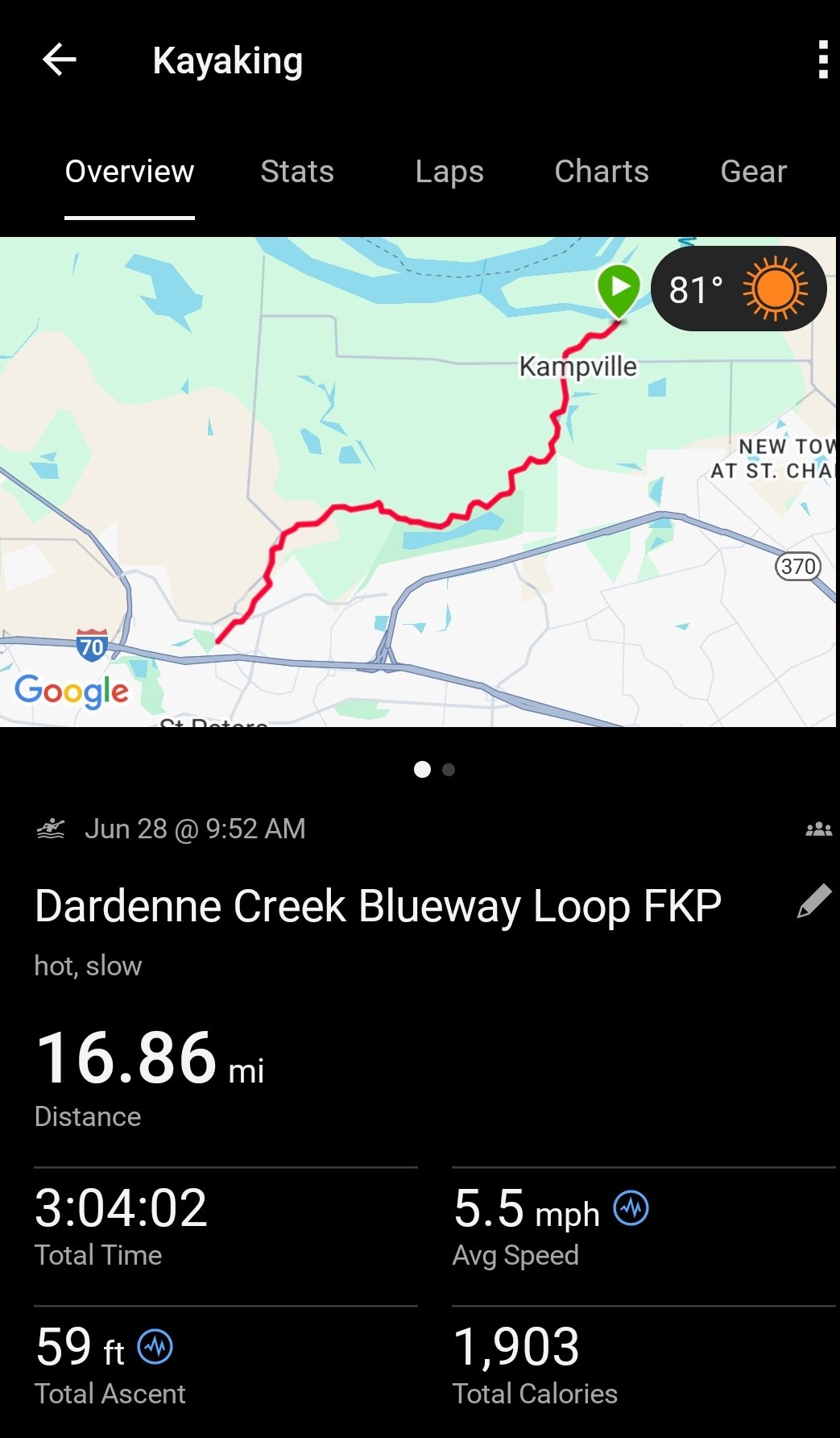
Overall Fastest Known Paddle: 3 hours, 4 minutes
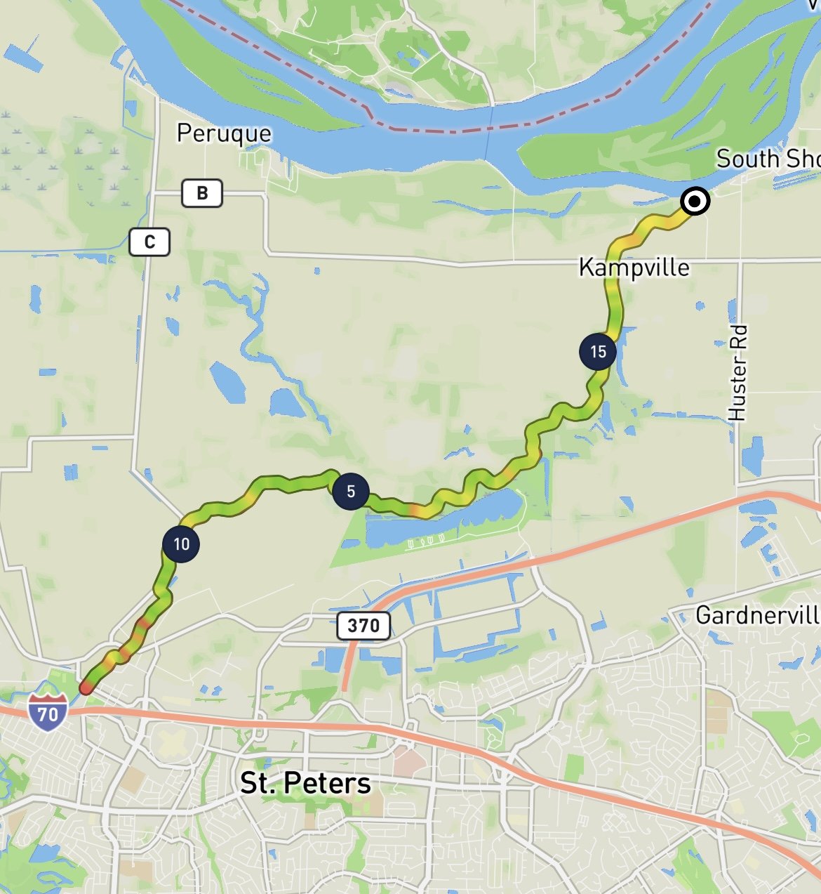
17 miles
Peter Larson of Ballwin, MO, age 46.
June 28th, 2025
Note: this is an out and back route, with the same start and end point
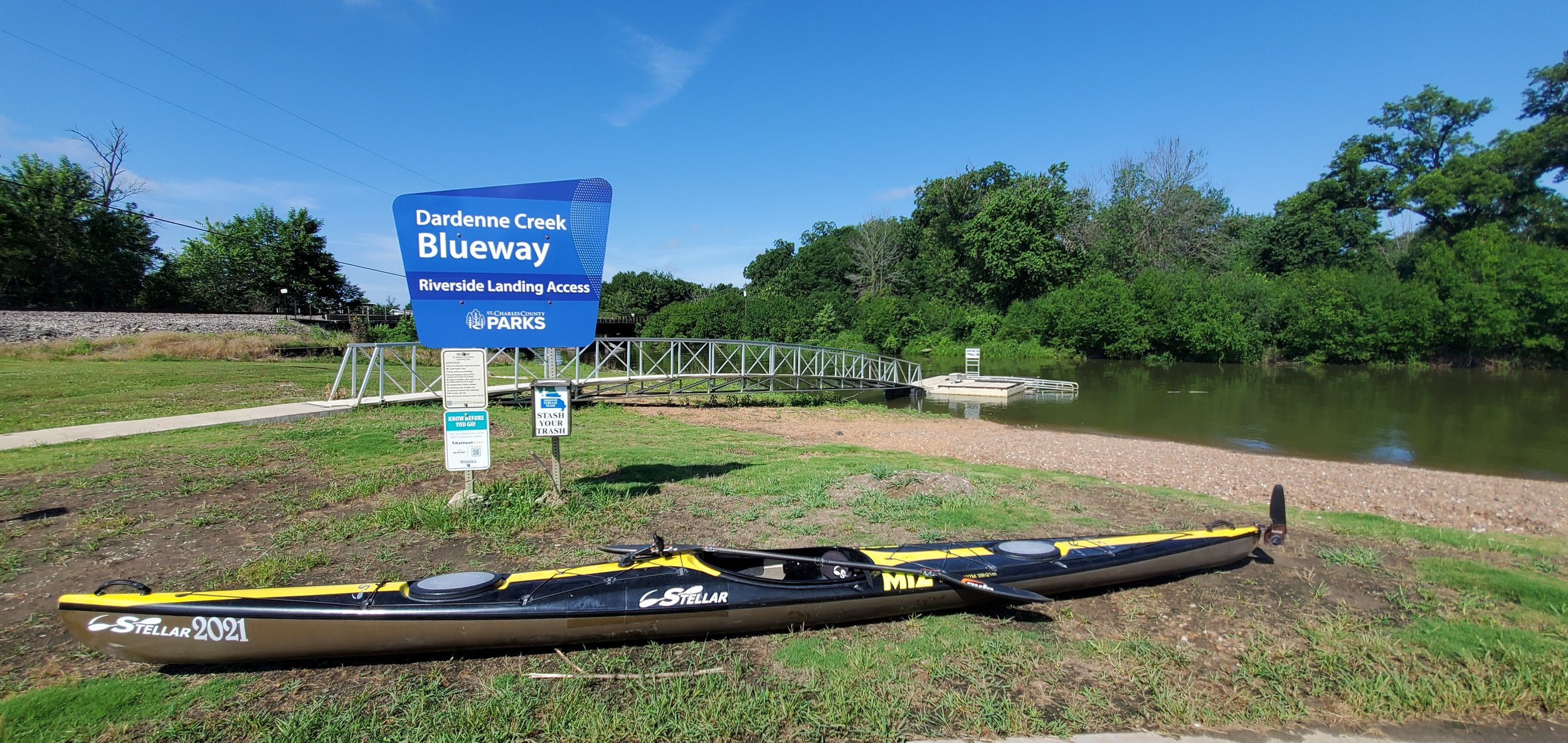
Start and Finish: Riverside Landing at St. Charles County Park, Kampville, MO. Peter started at 9:52am
Turnaround spot 1/2 way: Dardenne Creek Blueway ramp, St. Peters, MO. Peter finished at 12:56pm
Map resources/ route info from St. Charles County Parks
Unsupported/Self-supported
Solo Male
Boat used: Stellar 18R Multisport Kayak
Route proposed by Peter Larson, who writes:
This loop involves putting in at mile 0 where Dardenne Creek empties into the Mississippi and paddling upstream to the upper access point at mile 8.5 before returning to the start position. Much of the run is backwater from the Mississippi depending on the Mississippi's current level. The upper portion of the route is more free flowing. The course meanders and narrows as you navigate up the channel. The creek is being improved by St Charles County as a navigable blueway for the public to enjoy and is current in phase 2 with 8.5 miles of accessible paddling. The start and stop location is the kayak ramp at the mouth of the creek. There is a stairway that comes down to the creek from the parking lot access point that is the visible marker for reaching the turn around point. There are large blue markers along the side of the creek every mile as you paddle up the route that denote the distance(1-8)
Peter says he is “Just a lifetime paddler who has transitioned from 20 years of whitewater kayaking to distance paddling. I love exploring new bodies of water, especially rivers and creeks, and am always looking for a new challenge or adventure.”
Trip Report:
This is a fun and reasonably accessible route for anyone. Being an up and back loop, logistics are fairly simple and with a total length of 17 miles, does not require a great deal of planning. The run starts fairly benign at a boat ramp and county park. Easy, secure parking with an improved ramp and dock just for kayaks/canoes is a plus. The course as planned and run starts at this kayak dock. For the first 3/4 of a mile, a number of river homes and properties line the south bank, many with their own docks. Past them, the creek remains wide and fairly straight for another mile. At mile 1, you pass under a bridge and will see a blue sign on the left marking the milage. These will be present all the way up and always on your left. Miles 2 and 3 start winding a little more but remain wide. At mile 3, a side creek enters on the left and has a sign directing you to an access point at Lakeside Park, which is about a half mile up the side creek. I did not paddle up this as my goal was the upper access point. Now the creek is more shaded and lined with trees. There still was no discernable flow but more submerged wood to watch out for at times. This would continue till around mile 6.5 when I saw the first signs of some current moving cottonwood seeds around. From mile 3 to 6.5, the creek gradual narrows while remaining very windy. There are signs of bank stabilization all along the course and, at times, large pipes from pumps in the farmland used during flooding. Mile 6.5 till 7.5, the creek really narrowed up and the current became very apparent. The run was definitely more river like than channel finally. From mile 7.5-8.5, I encountered numerous small riffles caused by rocks that had fallen down from the rock stabilized banks and the creek had narrowed to no more than 10 ft wide at times. Navigation here was more critical as I attained up the current while dodging wood and rocks in the water and low hanging branches. This was definitely the sporty part of the course. I passed under several bridges and a rail trestle in the final mile as well. After the mile 8 sign, there was one more bridge as I reached the upper access point. This is a set of cement stairs coming down the bank from a parking lot with a metal rail system for sliding a kayak down. A nice access point for someone just wanting to paddle downstream. I could barely turn my 18ft boat around here with a foot of clearance and had to raise my rudder to prevent it from snagging the far bank. The paddle back down started fun and enjoyable, paddling down the current now and making quick adjustments through the "rapids" that I had attained on the way up. I may have pushed a little hard here and the heat started getting to me by the time I had gotten back down to the mile 6 marker. Now the markers were a reminder of how much more I had to paddle to reach the takeout. I had only brought a single 30 ounce squirt bottle of fluids and it was out by the mile 4 marker just as I was entering the less shaded portion of the run. It had always warmed to 90 by this point. I just had to grind out the last 45 minutes, watching as each landmark passed that I recalled from the trip up the creek. At last I came to the 1 mile bridge and the homes on the bank and could see the finish. I was pushing for sub 3 hours at this point but realized I had paddled too casually on the way up and couldn't make up for that now being overheated and tired. I paddled past the starting dock and hit the timer, and the shore. It felt good to get out of the boat and sit in the water, even if the water quality is not the greatest. Overall, a fun little adventure run with a great deal of wildlife (birds, fish, and lots of turtles) and an evolving stream from Mississippi side channel up to winding little creek with lots of current and obstacles. Added bonus of being just outside of suburban St. Louis/St. Charles so easily accessible to anyone