
DES MOINES river, MN/IA/MO Overall FKP Details
Des Moines River Overall Fastest Known Paddle: TBD
457 miles (approximately)
Route submitted by Trevor Boyer; he hopes to do this route at some point in the future.
Start: Below the Talcot Lake Dam (at the carry-in access), north of Dundee, MN.
Finish: Riverfront Park/Goose Landing on the Mississippi River just below the confluence, in Warsaw, IL.
Route Description from Trevor Boyer & Scott Miller:
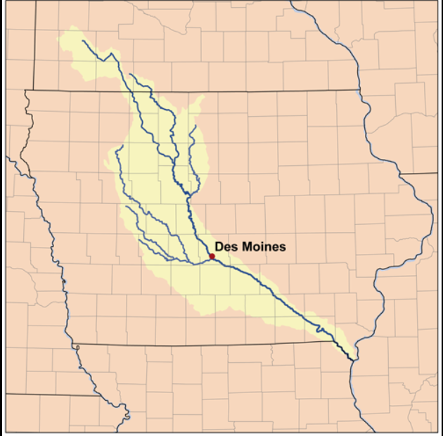
Trevor and I (Scott Miller) decided to have the route start below the Talcot Lake dam because that’s the start of the official upper river route as defined by the Minnesota DNR, meaning it is usually runnable starting at this point. At the start you are on the longer of the two upper “Forks” of the river; the West Fork. The West Fork and East Fork come together in southern Humboldt County Iowa. Above the city of Des Moines there is a portage around the Saylorville dam that creates the Saylorville Lake reservoir, and there is a second dam, the Red Rock dam, near Pella, Iowa that forms the Lake Red Rock reservoir. There are two known rapid sections, one in Des Moines and the other just north of fort Dodge.