Kansas River 2nd Overall , 2nd solo FKP Details
Kansas River 2nd Overall Fastest Known Paddle: 1D 20H 0M
(this is also the 2nd fastest solo FKP)
Ryan J. McCoy, Lawrence, KS
173 miles
Supported
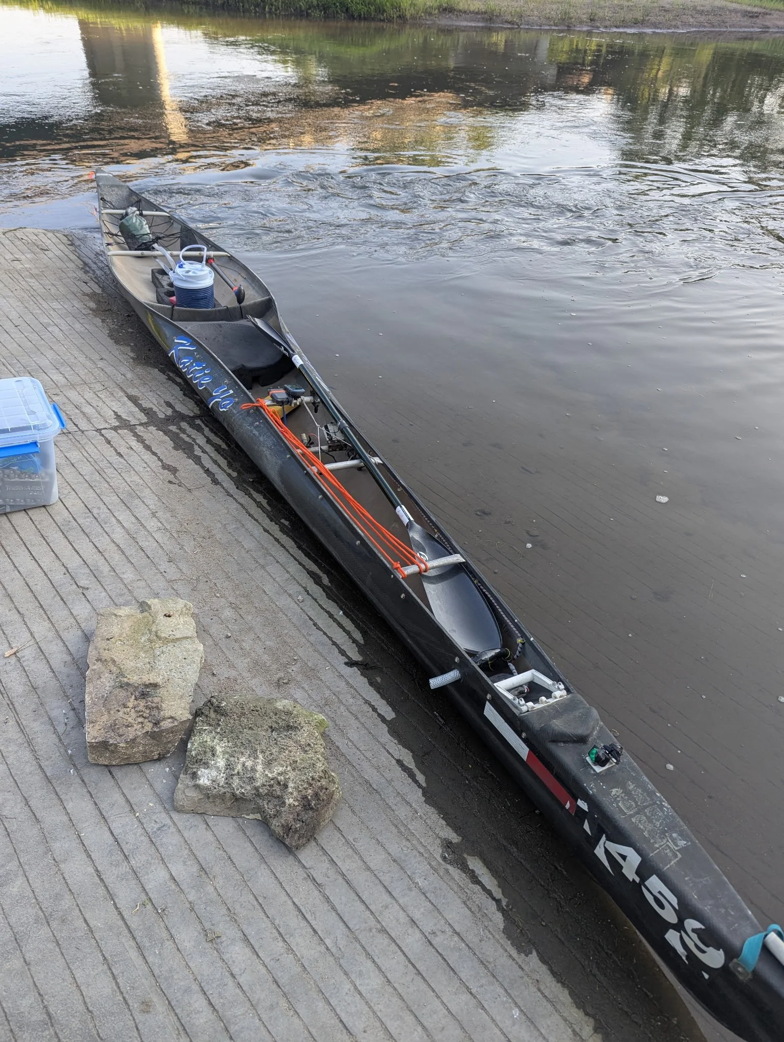
Boat: Spencer X-Treme Solo
Paddles: Epic Club Carbon Small Mid-Wing 210-220 cm and ZRE Bent Shaft Single Blade
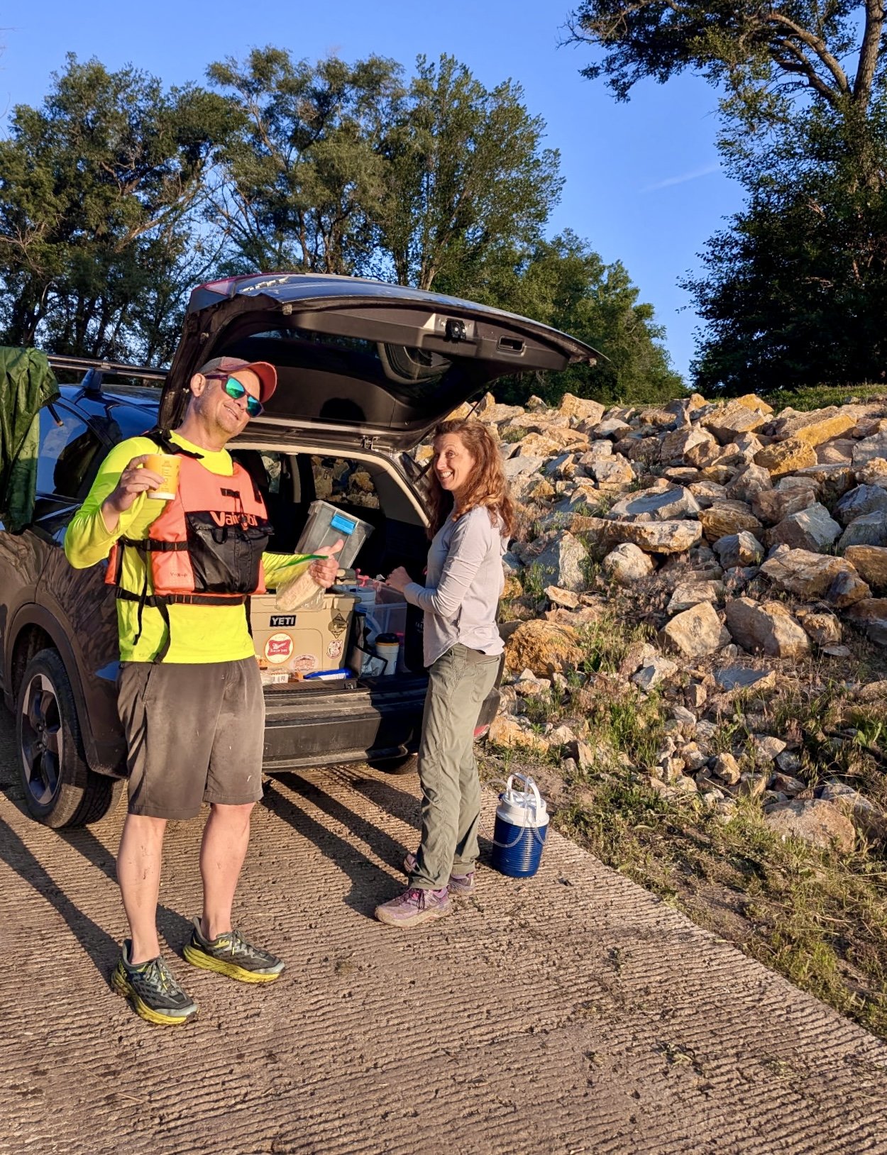
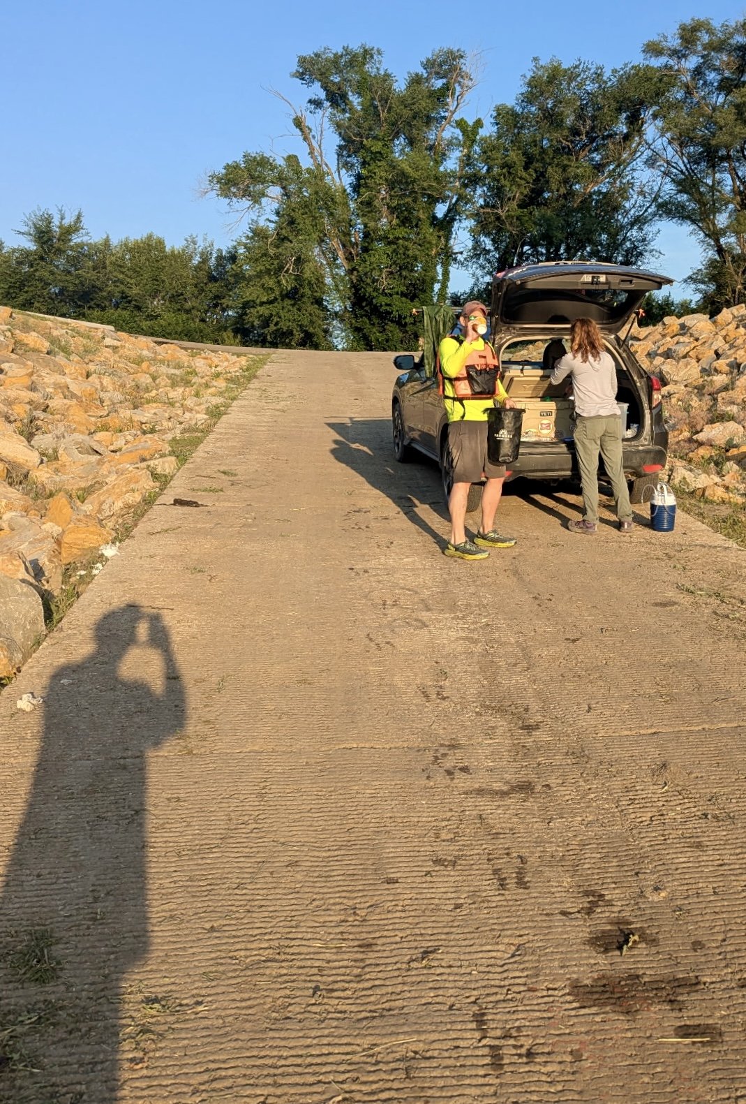
Support Crew: Amanda, Scott, Kate
Start: Kansas River Junction City Boat Ramp. Junction City, KS. 7:42am, June 10, 2025
Finish: Confluence with the Missouri River, Kansas City, KS. 3:42am, June 12, 2025
Map resources from Friends of the Kaw
Trip Report from Ryan:
Photos and Videos: Google Folder Link
Prologue: The Fastest Known Paddle of the Kaw River Started in 2000
In May or June 2000, I convinced my roommate Brian to borrow an aluminum canoe from a Boy Scout Troop leader and set out to complete a trek on the Kansas (or Kaw) River from Manhattan to Topeka. With a hand drawn map on a trifold brochure from Pathfinder Outfitter in Manhattan, KS, we set out with a small tent, water, and some hotdogs. We’d floated some party rivers in Missouri, so we thought this would be fine.
Low waters, headwinds, a heat index that had risen to over 100 degrees, and thunderstorms all night long left us crawling to a Maple Hill take out short of our goal on day two. As we baked in the sun awaiting our shuttle, I was surprised with how brutal the Kansas River could be.
Over the next few years, I paddled a bit on local “lakes” and on the Kansas River around Topeka by myself with shuttle help from my parents and friends. In July of 2009, I competed in the Gritty 50, a Rivermiles race described by race director Scott Mansker as “50 Miles of Sun, Sand and Sorrow.” It was. I arrived at the portage of the I-435 bridge 35 miles in with spoiled drinking water just after the checkpoint time. He allowed me to continue, gave me some water, and I finished about a half an hour after the cutoff. Looking up from the deserted Kaw Point boat ramp, I saw only Scott and my dad. Scott handed me a finisher mug and suggested that I may want to get a better boat than the heavy rec kayak and paddle I wrestled with for the last 10+ hours.
I often wonder if I’d still be paddling if I was turned away at the portage. In August, I bought a better kayak before opening the Waverly checkpoint as a volunteer recording times for the MR340. I drove back home after dark and watched the results roll in while sitting in meetings for work the next day.
In 2012, I prepared for my first MR340 attempt by failing to complete the second Kawnivore river race from Manhattan to Lawrence with another takeout at Maple Hill. However, two paddlers from Topeka, Dan and Lee, led me through the darkness to the takeout and vowed to look me up to go paddling later. Dan called. We paddled the Kansas River that summer, and I completed the MR340 in 67 hours, good enough for 22nd place in Men’s Solo. My parents and spouse Amanda served as ground crew.
Over the years, Dan introduced me to a crew of Kaw River paddlers and campers some of which have completed the whole Kansas River while camping. They’ve also biked across this great country, completed the Appalachian Trail, and explored smaller rivers in Missouri and across the United States. Boats have been traded. Stories of their lives and excursions have been shared under the stars around sandbar campfires. Dan, Flattop Sam, Catfish, Joe, Bob, Ducey, Lee, Pretty Sam, Yellowman, Eileen, and others made me feel welcome and taught me about a river that had always been in my backyard. We have paddled in all types of weather and all sorts of stretches along the 173 miles. I should also mention a special thanks to the unknown folks of the Friends of the Kaw organization under the previous leadership of Mike Calwell who spearheaded the effort to build concrete boat ramps along the river.
In 2014, Amanda and I prepared to complete the MR340 as a mixed tandem team. High waters pushed the attempt into the school year, so these two teachers waited until 2016 to complete it with my parents running support through day and night to a 64 hour finish and 4th place in Mixed Tandem. This was probably the best shape I’ve ever been in, but Amanda was the engine to make that Minnesota II roll.
In 2018, I soloed the MR340 with Amanda as groundcrew posting a slow and steady 55 hour finish good for 38th place in Men’s Solo.
In 2023, Dan and I decided to take on the Texas Water Safari. Hot, low, and slow through the course with 3+’ rollers on the final bay crossing to finish made me think the race had truly lived up to the “World’s Toughest Canoe Race,” but these first timers from Kansas finished the race much to the surprise of the Texas locals.
As Dan says though, the Kaw River can train you for anything.
Fastest Known Paddle - Kansas River
Ever since I started camping with friends on the Kansas River, I dreamed about stringing together a week-long trip to paddle it. This spring, I noticed the Fastest Known Paddle didn’t have an entry for the Kansas River. I figured if I ever wanted to hold the record, I should probably do it first. I didn’t think I’d be doing a “rocket run” as the through paddle when I first envisioned it but started planning for a sub-48 hour run. Amanda said she was on board to support, so we looked to the first full moon of June. We figured we’d still have some decent water and good temperatures because I’d rather be warm than cold. In the past, the most hypothermic I’d ever been was during the night of summer endurance paddles.
A couple weeks later, I got a text from Scott [ed: Mansker, founder of the famous Missouri River 340 race] asking if I’d seen the FKP website. He also offered up his Spencer X-treme, a Texas Safari style boat, if interested.
“Well,” I thought, “Mom always says ‘things happen for a reason.’”
“Let’s do it.”
Day 1 - Easy Miles
The long term forecasts kept indicating little to no wind and moderate temperatures. While I worried the Army Corps of Engineers wouldn’t start releasing water from our four major reservoirs in order to buffer the flood waters from the rains farther south and east, the last forecast showed a significant release--for the Kansas River.
At dawn, with perfect conditions forecast, Amanda and I drove from Lawrence to Junction City to meet up with our third member of the team, Scott. I had thoughts of starting at sunrise to get as much light as possible, but I also knew I wanted to see the rapids at Tecumseh just east of Topeka in daylight. No reason to rush down and wait.
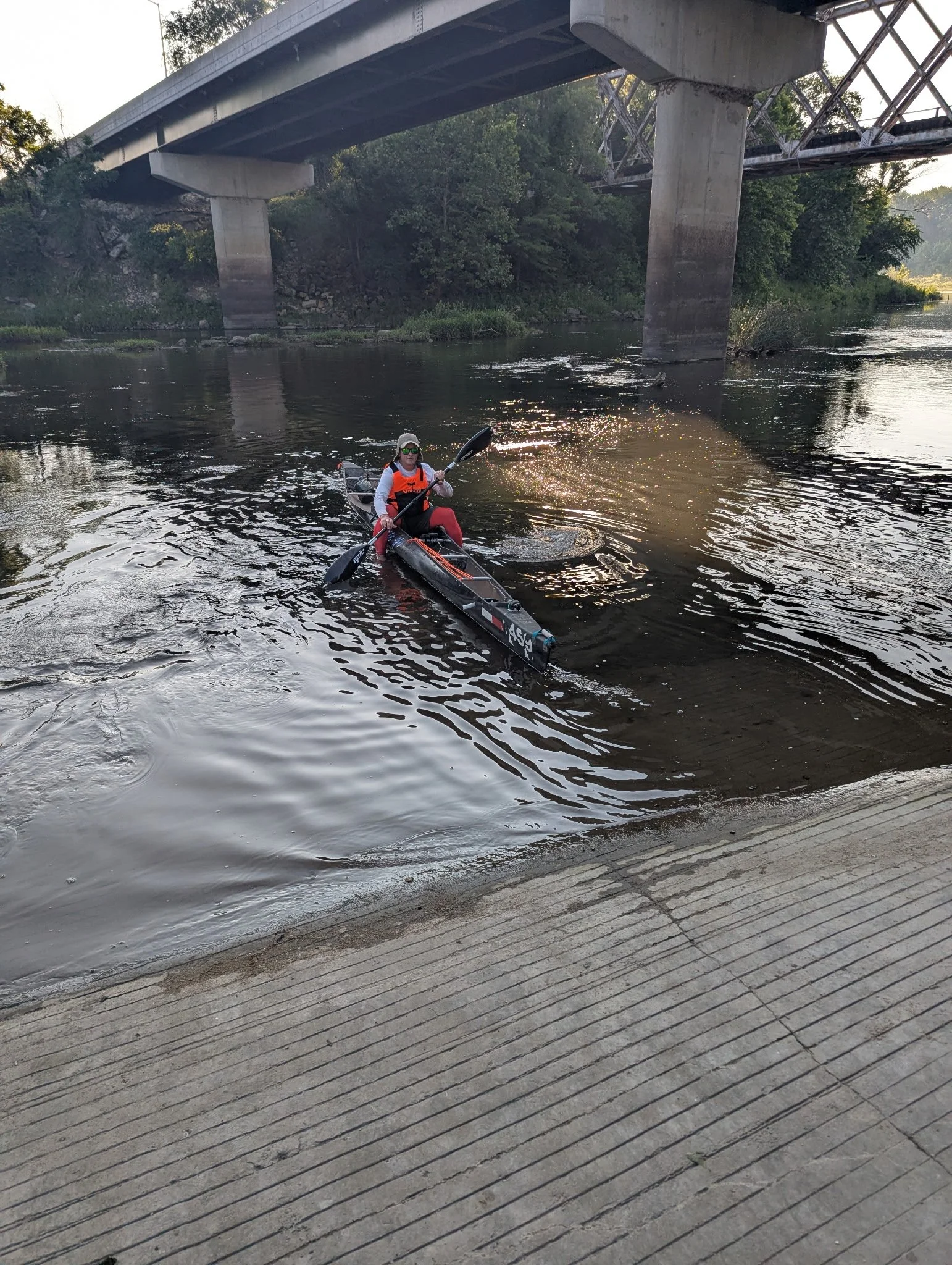
After loading up the Spencer Canoe and checking the Spot Tracker and Garmin eTrex 22, I set out from Junction City, RM 173, at 7:42 a.m June 10, 2025 encouraged by the Colorado and Kansas waters from the 453 mile Republican and 575 mile Smoky Hill Rivers that were high enough to carry me through the notoriously shallow opening 24 miles of the 173 mile trek.
A couple miles down from Junction City, I realized I didn’t tell Amanda I loved her, and I was still wearing my wedding ring. Knowing I would remedy both problems at the Ogden Boat Ramp, an unplanned stop, I turned my attention to my river buddy Catfish’s AT advice: “Remember, eyes and ears,” and, “hike your own hike.”
Yes, I’d be pushing to set the Fastest Known Paddle, but I’d only finish if I let the river guide me, remembered the lessons learned, and worked with her rather than trying to beat her or get a time. I’ve only felt pain and dumped on the Kaw when I forgot to respect her.
From Junction City to Ogden, the Kansas River winds through our Fort Riley Army Base. Fort Riley is home of the 1st Infantry, the oldest continuously serving active-duty division and the reason my father made his way from the hills of Ohio to the Flint Hills of Kansas. In addition to the reeds and tall grasses of a small stream, Blue Heron and morning birds ignored the daily commutes of our soldiers arriving for work. I wandered through the small river to Ogden, RM 163. Stepped on the boat ramp to tell Amanda I love her, passed off the wedding ring for safe keeping and blister prevention, and headed down to Manhattan.
Passing Wildcat Creek and turning north to Manhattan, I heard a helicopter approaching from upstream. Turning to take a look, a Blackhawk followed the river a couple hundred feet from the deck and flew overhead. Approaching my old stomping grounds, Kansas State University, I pulled under the K177 bridge below KS hill, RM149, for a bit of lunch and continued on hoping to get some more water from the Big Blue River and Tuttle Creek Reservoir.
With 1200+ cfs added to the widening river from the Blue, I spied a Great Egret or white version of a Blue Heron, something fairly common more than a decade ago, but a bird I hadn’t seen in years. Belted Kingfishers, Canada Geese, swallows, ducks, and other river fowl entertained me as I passed St. George, RM 137, and continued on to Wamego.
About a half an hour up of Wamego, RM 128, I ran into recreational kayakers, sunburned and happy, floating down from Manhattan. As is tradition with any paddler interaction on the river, they asked, “Where’d you put in? You look like you can go fast in that.”
With a bit of a laugh, “Junction City.”
“Where are you pulling out?”
“Well, Kansas City, but I’m taking a break at Wamego. I’ll see you up there in a bit.”
About 4:30 p.m., I slid into one of the best access parks and easily accessed towns on the Kansas River. I was welcomed by my parents and Scott. At the top of the ramp, Amanda had dinner ready to go. After about 20 minutes of rest, food, and discussing the trip thus far, the other paddlers hit the ramp reminding me that the clock was ticking and night was fast approaching. Loading back up, we decided to revisit our night plan at Belvue a little less than two hours downstream.
As I pulled into Belvue, RM 119, a local resident with two kids was launching their fan boat, an incredibly noisy addition to the Kansas River that has not been a happy one for most paddlers, but it was good to see the family out on the water for a sunset run. Still a little ahead of schedule, we turned on navigation lights, switched out some items, and got ready to run dark into one of the more difficult reaches of the river to read even in daylight.
The plan? Make it to an unscouted sandbar beneath a county road bridge about 17 miles downstream to sleep in the RV Scott had graciously brought along for the trip. If I was feeling good, I would continue on downstream and take a nap on a sandbar. However, I knew good water meant less sand.
Night 1 - Work
Amanda waved from the Maple Hill bridge, RM 107, and I continued on.
As the sun set, the wildlife put on a show.
I took a few minutes to float sideways to take the colors to the west. Turning downstream, a beaver swam along next to me for a spell unconcerned with the paddler next to them. Heron squawked every time I approached. A family of deer hanging out on a soupy sandbar made for the shore, giving me the depth of the various braids of the river to highlight my way. Fairly comfortable, I continued to work my way downstream.
Night set in.
Although the full moon was up, it stayed fairly low in the sky and the south bank trees cast a long shadow across the water hiding some of the keys I usually use to make my way. By the time I rolled under the Willard Bridge, RM 102, it was a little after 10:00 p.m.
I was gassed. I needed to sleep.
Amanda and Scott helped me navigate the dark, mud, and moat to work our way up to the RV. During the process, someone from the shoreline called out, “Need any help?”
All three of us started to wonder which local law enforcement officer or local we’d be informing of our trip. A bit closer, I realized it was my cousin John who set out in the dark after putting the kids to sleep to wave and offer encouragement. We thanked him. I threw on some dry clothes with more difficulty that I would like to admit and the support crew and I laid down in the RV for a planned rest of two and a half hours to start paddling again at 1:30 a.m. With trains barreling by within a few yards of the vehicle and my mind playing out different scenarios, I didn’t think sleep would be possible.
In what felt like 10 minutes later, our alarms woke us up. Sore and cool, we picked our way around through the dark, mud, and moat to get back on the river. I uttered my usual phrase, a variation of something my dad would say in times like these, “Whose bright idea was this anyway?” Amanda never seems to take ownership in these moments. I blame Scott.
Paddling, and hiking a few yards, through the 10 miles of sandbars above Topeka in the dark, I was thankful to make it through a large portion of the previous 10 miles with sunlight. However, I also knew I’d be approaching one of my biggest concerns in the dark counting on the city lights to help me through.
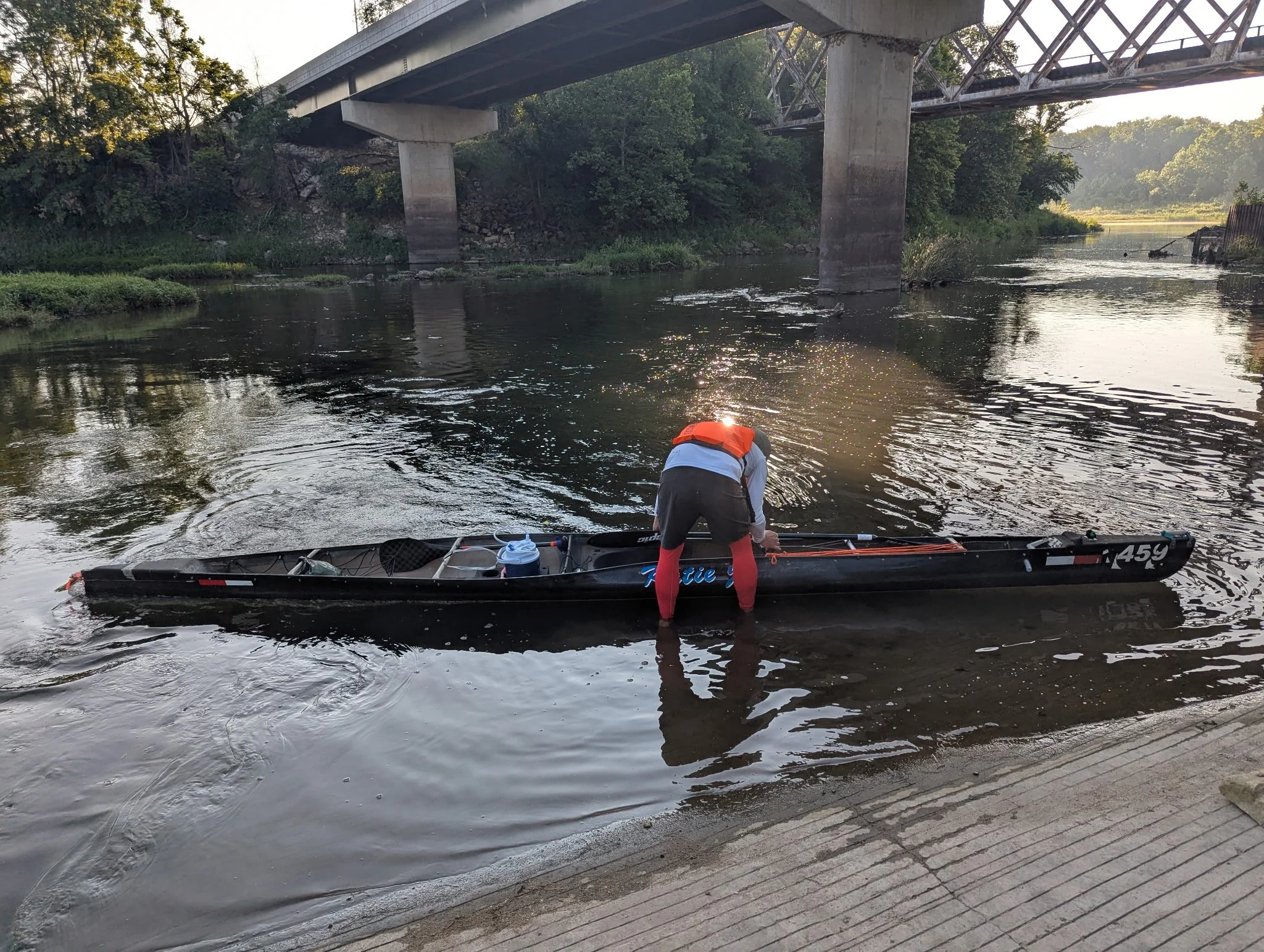
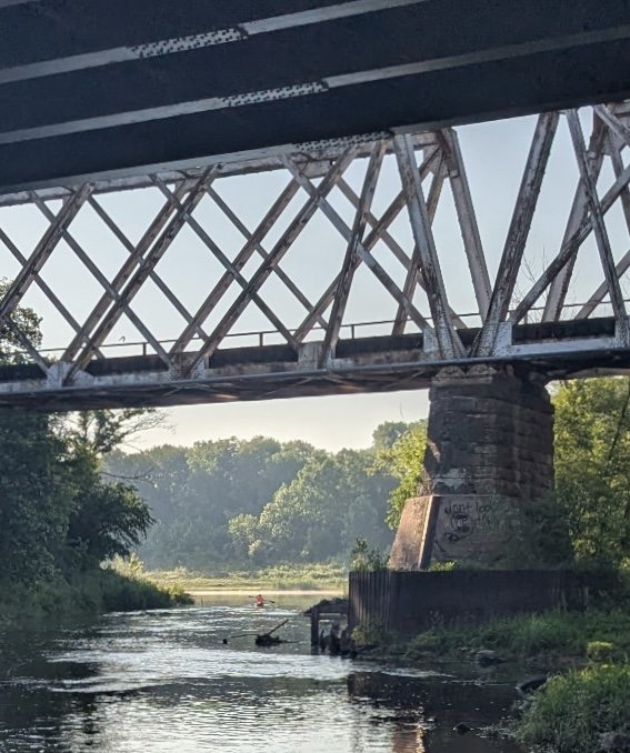
Approaching the Topeka Weir, a low head dam, at RM 87, I slowed my pace. After multiple deaths at this spot in the river and advocacy from their families over years, lighted signage and improvements along with a portage and paddle pass on river left have been added. My daylight scout a week prior, however, highlighted some concerns. At our water level, around 2500-3000 cfs, the channel left is sanded in. If a paddler is to take the safer river left option, they complete a portage over a well established sandbar, or pick their way across some shallows, wing dikes, and paddle across the face of the dam a few yards upstream of the river right rapids that should be avoided. If the river is higher and flowing over the top of the dam, I would not take this course. Cautiously, I followed the path rehearsed with plenty of light from the water treatment facility to guide my way to the upper ramp.
Awaiting me, as always, was my trusty support crew. This time some roller foods and hot coffee from the nearby 24/7 gas station. After a short break, Amanda reminded me of what I learned scouting the upcoming section, and I floated through the paddle pass waiting for the sun to rise.
Day 2 - The Pain
Affectionally known as the “Gutter Run” by Dan, the 9 miles through my hometown of Topeka were uneventful and calm. Normal hazards around bridges avoided, we planned on a short stop at the Seward Access before navigating the rapids and low head dam of the former power plant in Tecumseh a mile or so downstream. As my shoulders started chirping from 80+ miles of paddling, I noticed a small rubber duck floating in the current. I altered my path a bit, and fished it out with a bit of a grin.
Then, I was annoyed. Scanning downstream, there may have been 100 more. After joining Missouri River Relief and Friends of the Kaw for river clean up and education events, someone’s idea of fun dumping plastic toys delivered from the other side of the world into our stream distracted me from the natural flora and fauna of the first day.
Chalking it up to naivety and an opportunity to engage people to enjoy the river in a different way, I pulled into Seward for a snack, daygear, and a nagging fear that the shoulder pain may be more serious. Finishing was not in doubt, but switching to the single blade for longer sections was .5 to .75 mph slower than the double blade and long term injury was.
But, the Tecumseh low head dam and rapids were the first priority.
Tecumseh is a tricky section just down from the Shunganunga Creek, one of my childhood playgrounds miles upstream in town. In the mid 2000’s, I first floated over a four to six inch drop of the lowhead dam with little awareness of the hazard it could entail. Since that time, Dan and I had navigated “the notch” just to the right of the dam and left of the island and even the rapids river right in preparation for the Texas Water Safari. Today, I was just trying to make it through the section upright and without swamping the boat. Approaching slowly, I picked my way through the selected line and made it through cleaner than I had in 20 years.
The miles to the Perry-Lecompton Rising Sun Access, RM 64, were not as enjoyable. Even with the regular Bald Eagle sightings, shoulder pain and sleepiness could not be ignored. I found myself finding any excuse not to paddle. I’d sponge out some water, reapply sunscreen, eat something, fiddle with electronics, do math. I felt the heat of the morning creeping in.
I texted ahead to Amanda and Scott--I needed to sleep in Perry.
Passing the Delaware River and another 1500 cfs from Perry Lake, I noticed cool and relatively clear water at the boat ramp. It was a nice reminder how fortunate the conditions were for this run.
Dry clothes, an hour nap, and I was back on my way to our new home stretch of river, Lawrence.
The stretch to Lawrence posed a few minor challenges that the favorable weather conditions eased. First, “Lake Bowersock,” the pool above the hydroelectric plants in Lawrence, has extended a few miles upstream past the old coal fired electric plant. A slower current and a couple north to south sections create our “Wind Tunnel” which typically supplies a headwind no matter the conditions, especially in the afternoon. Second, the portage around the hydroelectric dam. Finally, my shoulders.
In my limited training runs for this endeavor and previous solo MR340 completion, I paddled with an Epic Mid Wing and a few lengths with the single blade. I’m a smaller paddler who basically stopped working out after the Texas Water Safari in 2023. Additionally, I’ve primarily used a single blade since Amanda and I completed the MR340 in 2016. I realized pretty quickly that I could consistently hold at least .5 mph faster with the double-blade, but I didn’t know how sustainable it would be. Attempting to find a solution, I picked up an Epic Small Mid Wing from John McCoy of Some Beach Outfitters a couple weeks before the run. Day 1, I could tell this was the right choice. I could hold a cadence and made great time. I was engaging the core and moving along. Day 2, my form was falling apart and the shoulders were letting me know. I started leaning on the single blade throughout the day--slower but manageable.
The Wind Tunnel gave me a refreshing sustained headwind of no more than 10 mph, and the portage was completed with little issue thanks to generous loaner of the lighter than expected Spencer X-treme.
Time for an early dinner in the shade of the powerhouse. Amanda scored some jambalaya from Terrebonne Po' Boys, and Scott provided the real sugar Mexican Coke. We watched a Blue Heron fish from the dam and plotted the next few hours. It was a perfect break before a longer stretch of 21 miles to DeSoto.
Passing the Wakarusa River at RM 42 added another 1000+ cfs from Clinton Lake, and I was feeling healthy again moving to DeSoto, RM 31. Doing the math approaching DeSoto, I knew I needed this to be a short stop. With my moving average hovering around 5 mph, every 12 minutes on shore meant another mile in the dark before arriving at Edwardsville, RM 16. I wasn’t completely worried about this section as I remembered two long straights and few major obstacles or tricky sections but these upcoming miles are probably the least known to me.
Approaching the boat ramp in DeSoto, I noticed an extra person with the support crew. Kate had joined the party after work. While stretching on the ramp, Amanda smiled with encouragement while refreshing water, supplies, and prepping night gear. Scott informed me that just ahead Dawn Buehler, Kansas Riverkeeper, and a group from Friends of the Kaw was introducing a group of kayakers to river paddling with a short evening jaunt to the Cedar Creek take out 5 mines downstream. I also received a pleasant surprise, Kate offered to bring her Epic V8 Surfski to Edwardsville and accompany me on the night paddle to the finish. Taking her up on the offer, the finish felt like it was in sight. As long as I could navigate a couple hours in the dark to Edwardsville, the ambient light of Kansas City, a reined in final 15 miles between flood controls, and a partner to talk to at 2 a.m. in the morning should make for an easy finish--as long as we navigated the WaterOne Dam and portage safely.
Onward! After seeing the Friends of the Kaw group taking out at Cedar Creek, I took the time to snap a few pictures and enjoy the sunset. I approached a sandbar with 20-30 American White Pelicans. I remember the surprise of seeing a flock of pelicans near Belvue in my 30’s. I had never seen them before. Now, a regular fixture of my paddles, I slowed my cadence and tried to get closer. In unison, the squadron took flight. Circling around the sandbar and my canoe once, bathed in the pinks and oranges of an early summer Kansas sunset, they continued their flight downstream and around the bend.
Night 2 - The Finish
Kaw Point Park, RM 0, is typically not a park one wants to spend a lot of time in after dark. The original plan called for setting out from Edwardsville after a bit of sleep around 1:30 a.m. to arrive at the finish with the sun rising above the Kansas City skyline. Pulling into Edwardsville a little before 11:00 p.m. though, I wanted to push on. The support crew had done everything they could to keep me on the water for 40 hours, and I had a partner to talk to for the last few hours. But after dark, my night vision started to drift toward hallucinations. Trees flattened out to 2D cutouts. Limestone banks started to read like large graffiti letters. Pulling into the boat ramp after slowly picking my way through a narrow section with an active, well-lit but night-blinding dredging operation and creek confluence, it was time to conference with the Team Captain--Amanda.
“I’m sleepy, but my body has bounced back. Are we comfortable with a night finish at Kaw Point? Is the portage manageable in my current state?”
After agreeing on a nap to tame some hallucinations, we decided to set out a little after midnight. Amanda woke me up after an hour nap that felt like two minutes of trippy dreams.
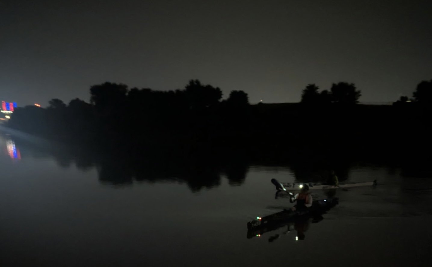
Kate was ready to go. I offboarded every unnecessary item and culled the emergency kit down to the emergency blanket, checked the headlamp and bike light I use for spotting. We started downstream with my navigation lights on, an afterthought in preparation.
Before too long, I called out near another active night dredging operation, “Cable.” Slowing to a stop, we identified a floating pipe circling 30 feet or so from the bank and a headhigh cable anchoring the dredge to our right to the opposite shore. After shining our lights around the area to find a suitable path for proceeding, the cable dropped into the water. We assumed the workers dropped it for us, so we calmly and quickly proceeded downstream.
A short time later, passing our last dredging operation, it was Kate’s turn to call out a cable I’d missed in the night blindness caused by the blazing lights on the dredge, “Cable!”
Dead ahead 5 or 10 yards in front of me at shoulder height was a cable. Backpaddling with urgency, I drifted right and slid over top of the submerged cable as Kate floated under the cable left.
After 160+ miles, the closest call was here in the final push. Remember, “eyes and ears.”
Next up, the last second and last portage. After scouting it a few days prior and paddling lower water level, accessing the portage path river left in the dark posed little trouble for us. With my boat overhead as portaged in Lawrence and Kate managing her newer version of an Epic V8 with a handle that mine at home does not have, we navigated the “path” of riprap down and continued our way downstream.
Conversations about the need for dredging operations for our construction needs, recreational paddling, jokes, tattoos, previous river races, and other random thoughts carried me through the pain creeping back into my shoulders.
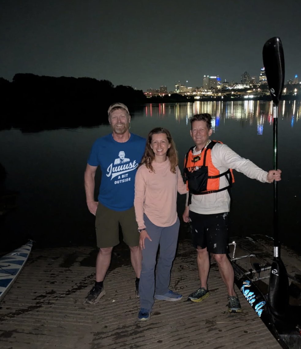
Eventually, more and more of the Kansas City skyline came into view. A short conversation with a late night fisherman and a couple folks with a fire on the bank made up the sum of the other people sharing a gorgeous night in the urban corridor that provided a stark contrast with the morning start in Junction City and the Flint Hills.
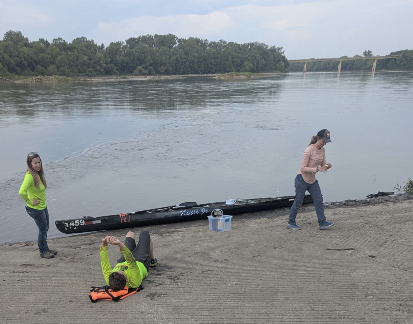
Kate noticed the time as we approached Kaw Point--3:40 a.m., a fun parallel to a race that changed my life, the Missouri River 340. After touching the ramp to complete the FKP time at 3:42 a.m., I poked on down to the point to take a moment taking in the skyline of Kansas City.
Epilogue - Paddling the Kaw
In the early 2000’s, I started paddling the Kansas River primarily by myself. Today, I paddle the Kansas River as part of a community.
When I started paddling, the dangers of moving water and the area around the river in Topeka were well documented and always at the back of my mind while paddle racing and paddling recreationally. Boat ramps in the area were and are known to be places where vehicles are damaged. Cold water paddling and its dangers were vague concerns, highlighted well in a book I recently read by Frank Bures, Pushing the River. Families had lost loved ones playing on sandbars, in local lakes, and around the dam mentioned previously in Topeka.
These dangers are always in my mind when I travel to the river.
On several occasions, I have gone to the river to paddle only to turn around because it did not feel right. I have slept or stayed off the river during paddle races to get my body and mind right before setting back out. I purchased a new PFD for this run to increase visibility and be sure I had something I could wear constantly or switch out with my other PFD, if needed.
For this trip, I had the good fortune of incredible weather, water, and people. I also knew that there would be no shame in folding, if needed. There is no reason to have others put themselves in jeopardy to fish me out of a river.
This trip was successful because my path crossed and continues to cross a multitude of people with knowledge of the river and how to paddle that will always exceed my own. I will continue to listen and learn more around campfires at river cleanups and campouts and through publications of other paddlers. With more and more people accessing our waterways, I hope we continue to do so with a healthy respect for our rivers.
GPS track (with explanations for any gaps):
Links:
Spot Tracker KML (eTrex Backup File with some extra training runs)
Gap Explanations:
I’m guessing that the Spot Tracker was set to power save when not moving. There are a few gaps that tend to happen after stopping at a boat ramp with my support team. Please reference the eTrex Backup Files for proof of completion of the sections below.
6/10 12:10-12:50 p.m. - Stopped at K177 bridge boat ramp in Manhattan for a break. Reconnected after being on the water for 20-30 minutes.
6/10 3:19 p.m. 39.096930, -96.376250 - I have no idea. This data point pinged from a distance away from the river.
6/10 10:03 p.m to 6/11 2:05 a.m. 39.097630, -95.946110 - Stopped with support crew under Willard bridge (RM102) around 10:05 and slept until 1:00 a.m. Back on the water 1:30ish.
6/11 4:32 a.m to 6/11 5:27 - Stopped at the upper boat ramp of the Topeka Weir Portage (RM87) for short break. Back on water a little before 5:00 a.m.
6/11 7:26 p.m. to 6/11 8:30 p.m. - Ten-minute break at DeSoto Boat Ramp (RM31) before setting back out.
Trip Details:
Junction City Kansas River Access (RM173) to Kaw Point River Access (RM 0)
Boat: Spencer X-Treme Solo
Paddles: Epic Club Carbon Small Mid-Wing 210-220 cm and ZRE Bent Shaft Single Blade
Start Time: 7:42 10 June 2025 (Spot Tracker has it 7:4ish a.m.)
End Time: 3:42 12 June 2025 (Spot Tracker has it at 3:45ish a.m.)
Break Durations:
9:20-9:25 a.m. 10 June - Ogden Access (39.105010, -96.695650)
12:10-12:30 p.m. 10 June - Manhattan/K177 Access (39.174740, -96.553590)
4:15-4:35 p.m. 10 June - Wamego Access (39.198000, -96.305010) Belvue Boat Ramp
10:05 p.m.-1:30 a.m. 10-11 June - Willard Bridge (39.097630, -95.946110)
4:30 a.m.-4:50 a.m. 11 June - Topeka Weir Access (39.073760, -95.716890)
6:45 a.m.-6:55 a.m. 11 June - Seward Access (39.060250, -95.594170)
9:50 a.m.-12:00 p.m. 11 June - Perry/Lecompton Rising Sun Access (39.050290, -95.387730)
2:50 p.m.-3:15 p.m. 11 June - Lawrence Bowerstock Access (38.976300, -95.234680)
7:25 p.m.-7:40 p.m. 11 June - DeSoto Access (38.985070, -94.974050)
10:44 p.m.-12:05 a.m. 11-12 June - Edwardsville Access (39.050730, -94.816860)
Portage Locations
2:45 p.m.-2:50 p.m. 11 June - Lawrence Bowerstock Portage (38.976840, -95.236390) (Video Evidence 1, Video Evidence 2)
12:40 a.m.-12:45 a.m. 12 June - WaterOne Weir Portatge (39.047250, -94.787940) (Kate Mansker witnessed)
Total Distance - 173 Rivermiles (174 on the GPS)
Trip Report (Technical)
Weather
Generally speaking, the river was slowly dropping especially early in the run due to reservoirs withholding water to help communities downstream with large amounts of rain in the previous week. From previous experience, I knew I wanted at least 2500 cfs for most of the run to help avoid sandbars and allow a more direct route. Fortunately, the Army Corps of Engineers scheduled an increase of releases the day of the FKP start which held the river steady for a bit longer. I was half tempted to start a week earlier with higher water but was uncomfortable with higher water levels at night along with lower overnight temperatures. Also, weather reports were looking good with winds below 5 mph for much of the run with some 10 mph winds for day two. The full moon on June 10 and 11 allowed for moonlight for most of both planned nights. Overnight lows were in the 70’s with daytime highs reaching low 90’s. Humidity was relatively low for this time of year.
Water Levels:
Junction City RM 173 - About 600 cfs (medium)
Manhattan RM149 - About 500 cfs (medium)
Tuttle Creek Reservoir releasing about 1200 cfs down Big Blue River
Wamego RM128 - About 2000 cfs (medium)
Topeka RM87 - About 3000 cfs (medium)
Perry Lake Reservoir releasing about 1500 cfs down Delaware River
Perry/Lecompton RM64 - About 4500 cfs (medium)
Clinton Lake Reservoir releasing about 1500 cfs down Wakarusa River
DeSoto RM31 - About 6500 cfs (medium)
Near I435 Bridge RM 15- About 6500 cfs (medium)