Kansas River 1st overall , 1st solo darin brunin 1D7H50M
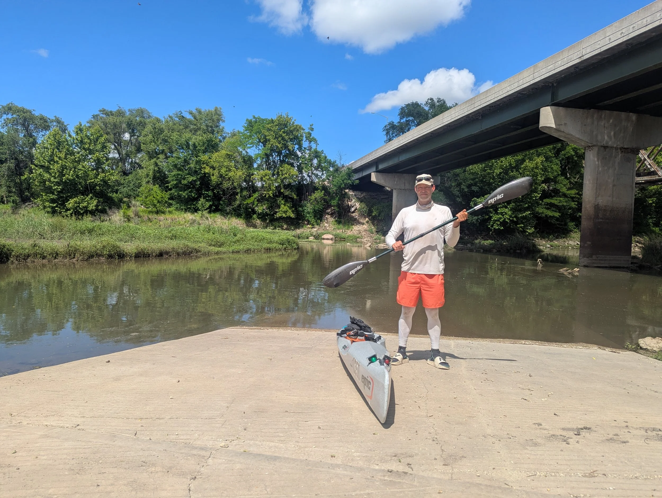


Kansas River Overall Fastest Known Paddle of 1D 7H 50M
set by Darin Brunin, 41, of Lawrence, KS
173 miles
Supported
Boat: Epic V7
Start: Kansas River Junction City Boat Ramp 4pm, May 29, 2026
Finish: Kaw Point, Confluence with the Missouri River 11:50pm, May 30, 2026
Map resources from Friends of the Kaw
Trip Report from Darin:
Introduction:
I consider the Kaw my home river. I grew up in between Rossville and St. Marys and some of my best childhood memories were camping, fishing and doing some float trips on the river though I wouldn’t discover paddling it until a couple of years ago. Southwest of St. Marys is where this was mostly forged on the family farm that butts up against the Kaw and is one of my favorite places.
In July 2024, I attempted my first MR340 in the same kayak(Epic V7) that I would be paddling during this fastest known paddle try. I had an unfortunate end to race with a DNF. Luck would have it though that at the end of that attempt, I met Ryan and Amanda McCoy who were part of one of the safety boat crews during that race. I also found out they also reside in Lawrence, KS just a couple minute drive from where I live. By chance, I met them again at the north Lawrence boat ramp last spring when Ryan was testing out the Spencer canoe that he would set the initial Kaw Fastest Known Paddle time in but I didn’t know that he was going to attempt it yet.
I had seen the FKP website become a thing earlier in the year and was curious about the Kaw because ‘someone’ had to have set a recorded fastest time in the past already. Doing a deep dive on Google yielded no results though and I couldn’t find documentation. My curiosity kept building and I messaged Ryan on Facebook a week or two later about if he knew where to find it. His response was along the lines of ‘Actually, I just set it a week ago. I also couldn’t find any information so I figured I’d set the baseline.’
After reading his trip report, I knew an FKP attempt of the Kaw was something I wanted to do but figured it would have to be in 2026 as I was laser focused on 340 redemption for 2025. This is the log of that attempt.
Ground Crew
Ryan McCoy - Lawrence, KS
Kellyn Young - Lawrence, KS
Paddling Partners
Nick Wastler - Lenexa, KS (1 mile upriver of Eudora to Edwardsville)
Ryan McCoy - Lawrence, KS(Edwardsville to Kaw Point)
Other Witnesses
Wayne Peters - Wamego, KS
Bob Angelo - Topeka, KS
Tyler Freeman - Lecompton, KS
James Guffey - Perry, KS
Dillon Killoren - Sherman, TX
Timothy Roy - Mission, KS
Section 1: 24 miles
Junction City to Manhattan: Phragmite Roulette
Kellyn dropped me off at Junction City around 2:30pm with my kayak, paddle and initial supplies but had to get back to Lawrence to work since it was in the middle of the afternoon on a Friday. After arranging everything and making sure nothing was forgotten, I bid her farewell and was on my own for the next several hours.
Getting on the water around 3:30, I paddled down from the boat ramp a bit on the Republican River and situated myself making sure everything was good to go from my mental checklist, especially the kayak. The minutes passed and I was just ready to get this started.
It was now around 3:50pm and all systems were a go, I just needed the clock to turn to 4pm. I sat just upriver from the confluence of the Smoky Hill and Republican Rivers, where the official starting point of the 173 mile Kaw happens, knowing that I had a long journey ahead but I had worked hard for this moment so I’d better make it count. Before I knew it, the clock hit 4 and I was off. Not having paddled this segment of the Kaw before and seeing the non-existent flow from the Republican and minimal current from the Smoky Hill, I knew the first 24 miles were going to be slower than planned but was prepared for it.
Not 10 minutes after the start, I had the first of quite a few beaver tail slaps of the trip happen, one of my favorite things to happen on the river. I always joke about how rude they are. Well, it’s one of my favorite things except for when it’s dark and it scares the crap out of you.
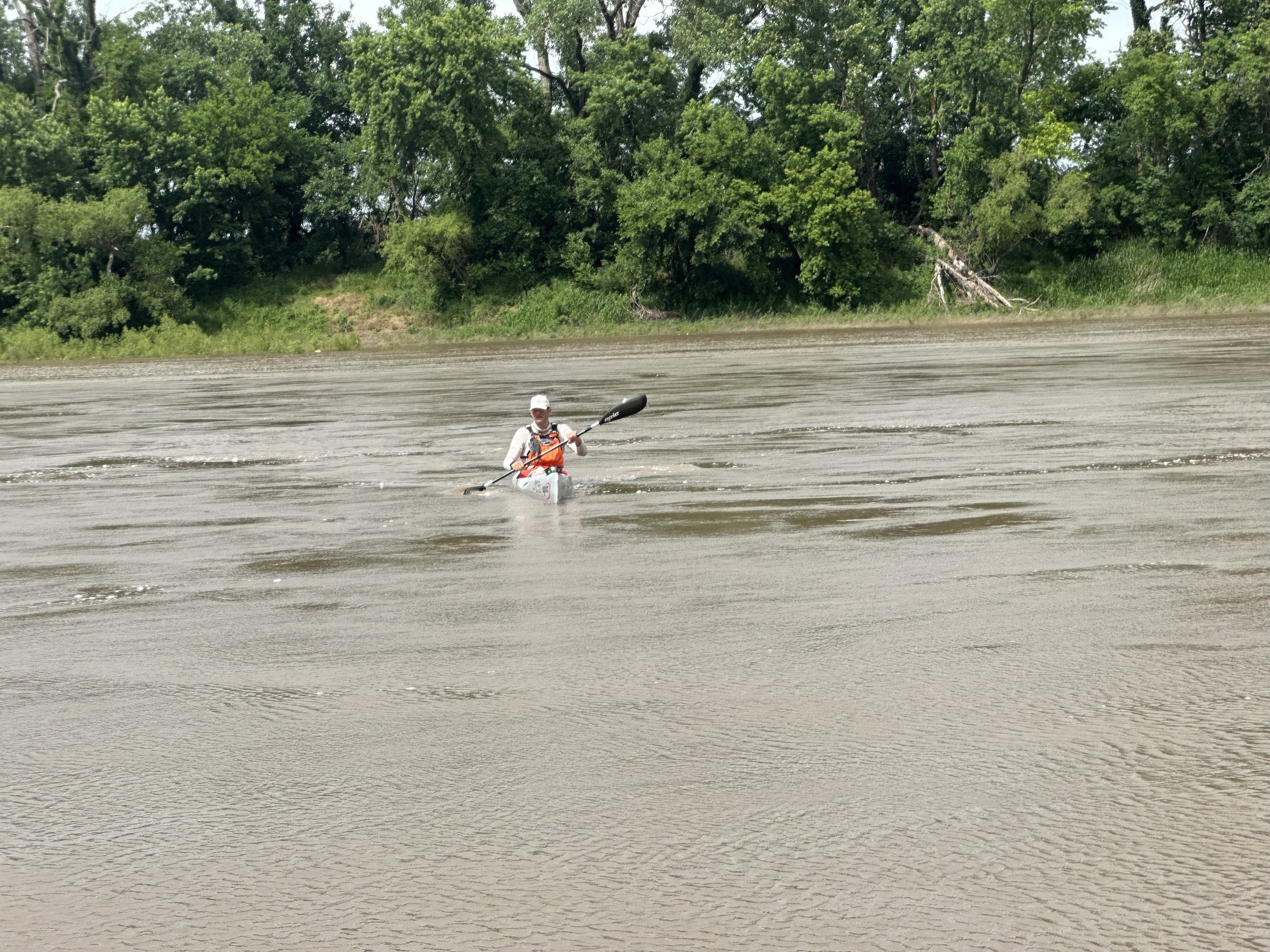
Moving along, the first 3 miles passed quickly and I was making decent time although it was muggy as heck and I noticed myself sweating a bit in the late afternoon sun. It was around this point that I started seeing more and more clusters of invasive phragmite grass showing up on sandbars and small islands in the middle of the river. Not only does this hamper open spaces for camping but the reedy grass also has deep enough roots that it prevents erosion on the clumps of river silt that it grows in, kind of creating a bunch of small islands that you have to guess what the best path ahead is rather than having a defined path ahead that you can see well and navigate efficiently. Miles 3-10 were especially notorious in my mind for this and I ended up being a ‘beached whale’ due to the shallow water numerous times through both my own probable poor navigation and inevitable sections of the water that were too shallow to pass through.
One of the trickiest parts about paddling the Kaw as a whole is how much getting in and out of your boat to move off sandbars wears you out throughout time, especially if you’re being aggressive about keeping a pace. If you jump out of the boat in a hurry and pull a 50+lb kayak off a sandbar repeatedly, it’s going to eventually take a toll. I was trying to be aware of this and take it easy and be mindful about not torching myself before the paddle was even 10% complete.
After around 10 miles the river opened up a bit and was somewhat easier to navigate and I was starting to lose some of the heat of the day, a relief. The river as a whole became a lot more scenic with the majestic Flint Hills rising above the river landscape along with numerous wildlife and thunderstorms off to the east. I was settling in and the next couple of hours moved by quickly and were relaxing for the most part as I approached Manhattan. Just a couple of miles from my first stop, I noticed a bit of increased flow from Wildcat Creek. Anything helps.
Moving in a more northerly direction now, I soon spotted Ryan for the first pit stop and made my way to the Manhattan boat ramp on the right side of the river. I spent 10 minutes here refilling bladders, eating a bit and doing some stretches and then it was time to head off once again.
Section 2: 22 miles
Manhattan to Wamego: Finally Some Flow
After giving Ryan a fist bump, I headed off in the sunset towards St. George and Wamego. I knew that I only had a couple of miles before gaining 5k cfs of flow from Tuttle Creek Reservoir at the confluence of the Big Blue and Kansas Rivers. Getting there seemed to take a while but once the Big Blue came into view, I picked up some energy knowing that the slowest water for the trip was now behind me.
Sure enough, I noticed my speed picking up as I cruised into the darkening evening sky and progressed towards St. George. Losing daylight though meant that I was going to probably slow down a bit for navigation hazard purposes but that was ok.
Getting closer to St. George, I noticed a thunderstorm had formed near Ogden where I paddled a few hours earlier. I could see that it was producing cloud to ground lightning but after checking radar on my phone, I figured it ‘hopefully’ wouldn’t impact me and it did indeed fizzle out with the setting sun but was a bad omen for later in the night.
After passing through some limestone bedrock rapid areas and a few more miles, I arrived at St. George. I heard someone yelling but didn’t know who it was but soon figured out it was Ryan at the boat ramp saying how good I was moving. Continuing to the east and seeing the lights of Wamego ahead, I was pretty eager to get there and time moved by shockingly fast. About a mile before Wamego, I was looking forward to seeing my friend Wayne Peters at his ‘river retreat’…a canopied patio area overlooking the river where he and his family hangout. They saw me turn a bend and head north towards the river retreat and flashed a light to let me know it was ahead. Hearing their cheers of how well I was doing really pumped me up and I was glad to float by but probably wanted to go up the bank for a beer. He told me to keep moving and then heard him ask if it was ok if he lit off a firework. I didn’t know what to expect but it was a big firework and I let out a Rick Flair “wooooo!,” just enjoying the moment of how cool this all was and was trying to soak it all in.
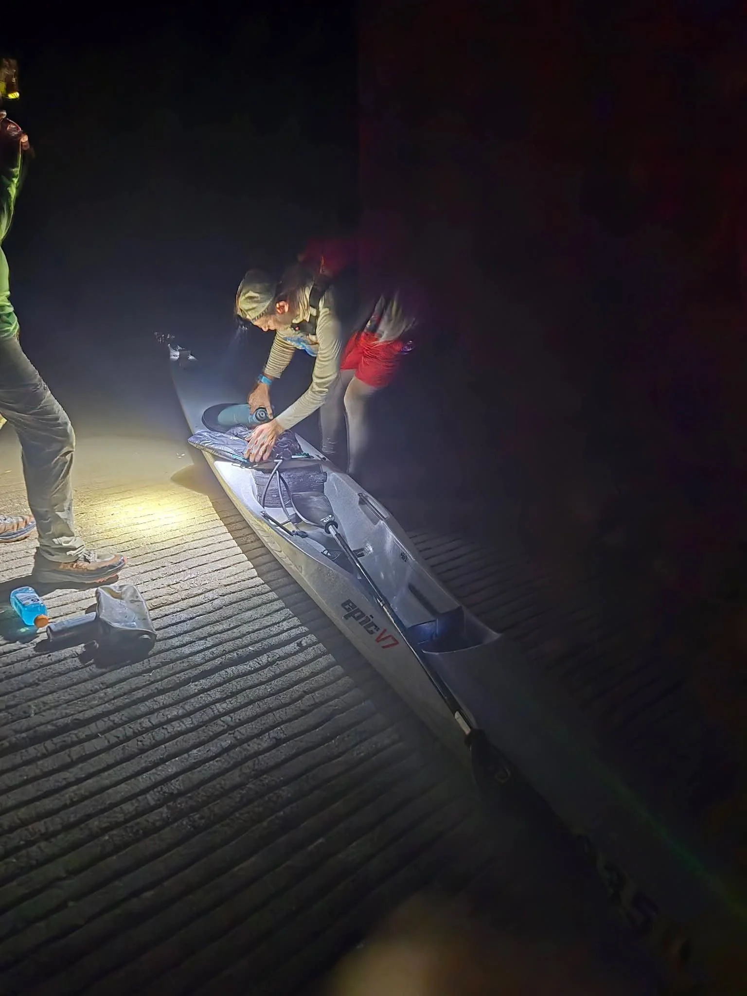
In 10-15 minutes, I arrived at the Wamego ramp to Ryan, Wayne and Craig McConkey waiting for me. Wayne and Craig had apparently booked it from where I saw them shortly before to the ramp and had planned to talk to me there. Another wonderful surprise and good conversation. We quickly but diligently swapped out supplies to make sure I was set for the next nearly 40 miles, the longest of the paddle, before I would see Ryan at Topeka again.
Section 3: estimated at 13 miles
Wamego to St. Marys: Where I Learned To Love The River
I really wanted to keep conversing with Wayne, Craig and Ryan but once again, it was time to go. I was looking forward to this section as it’s pretty straight forward, good paddling and I was looking forward to the section near St. Marys where I grew up.
An hour quickly passed as I moved past the Vermillion River and the low water head dam at Belvue, where the water intake is for the Jeffrey Energy Center. A mile downriver from that is the Belvue boat ramp where Ryan was once again waiting. As I passed, he mentioned that my RaceOwl tracker hadn’t updated for the last hour so I looked at my phone and pinged a location check so that it would start working again.
A few miles after that as I neared White Sands, where a former sand operation was located before being taken out in the 1993 flood, I could see fairly close lightning and Ryan called me to let me know that there was a storm to my east and south. I was growing more concerned by the minute and before I knew it, there was intense cloud to ground lightning just a couple miles away to my east, one strike illuminating the sky green as it struck a transformer in St. Marys. Feeling vulnerable, I knew I had to get off the river but wanted to get to my planned stop just a couple of miles ahead so I pushed on quickly and made it safely to my planned stop at St. Marys, then taking cover as much as I could as the storms passed.
Why stop at St. Marys? As I told Wayne in Wamego, I had to stop and visit my dad.
I knew this was going to be the most emotional part of the whole paddle. My dad, Dan, passed away in 2021 but I have so many memories of him growing up at that location. Fishing, hunting, finding morels…some of our best times together. I wouldn’t probably have been doing this paddle if he hadn’t sparked my interest in the river. I pulled out a stashed Miller High Life(the beer we used to share in his later years,) drank half and poured the other half out for him…thinking about how he’d probably jokingly tease me about doing something like this 173 mile journey along with being proud at the same time. Probably teasing me about the lightning as well.
Knowing that I needed to get going after about 15minutes, I said to him, “Well, I’ll be yakkin’ at ya later”...what he always said to me as I was hanging up the phone or leaving when talking to him in person. I was going to become dehydrated anyway if I stayed too much longer from a loss of tears.
My mom also lives about a mile away and as I was getting in my boat, I said goodbye to her as well. I figured she was either sleeping or awoken by the lightning but didn’t want to wake her up at 2am.
Section 4: 26 miles
St. Marys to Topeka: More Lightning Delays
Setting off again, I had major concerns about this section after doing several recon trips. The first big one is that this section of the river is heavily braided with shallow water and sandbars even at higher flow levels with many shallow pathways in between the sandbars . Easily the hardest section of the river to navigate in my opinion besides maybe the first 24 miles to Manhattan. You can’t try to finesse this section and always try to be in the non-existent ‘main’ channel or you’re going to be pulling your boat across sandbars every few minutes in the middle of the channel crossings. The second concern was the huge amount of trees that had been deposited here after a high water event in early May. Higher flow and speed are great until you crash into one of those big piles of debris in the middle of the night. I knew I constantly had to be listening and watching with my head on a swivel.
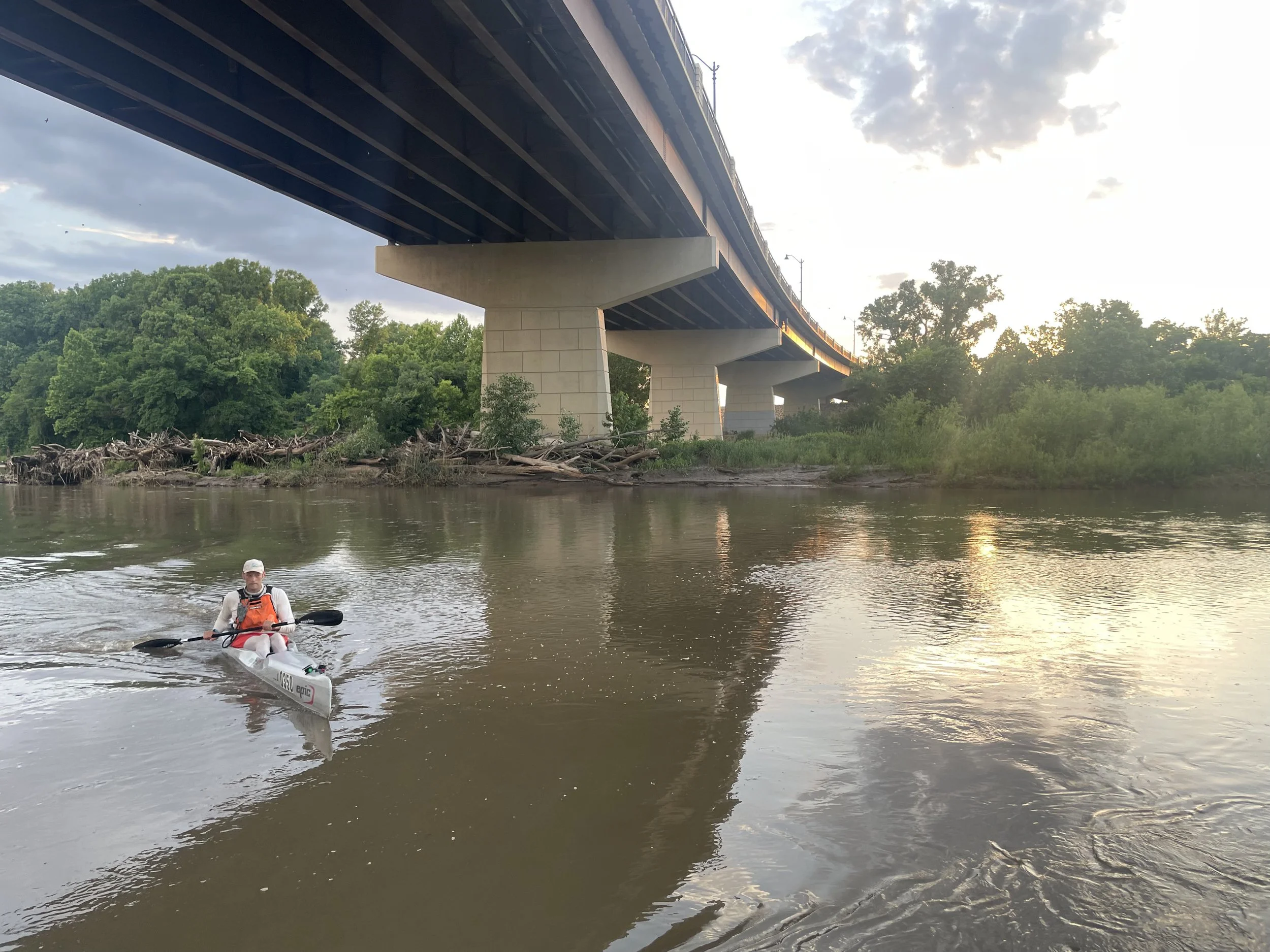
Making my way towards the Maple Hill bridge(which always seems to take forever to get to mentally) I discovered paddling was somewhat easier than I’d experienced during those previous runs and was so grateful that I wasn’t dragging my boat every 5 minutes like usual. After about an hour of paddling, the Maple Hill bridge came into view and I passed underneath with Ryan viewing from above. The next bridge ahead was Willard(Side note: My hometown of Rossville is just a few miles north of Willard) before doing the final sub-section of this section to Topeka. Making fair time, I approached Willard and was starting to hit a mental low point of this section seemingly always taking forever and knowing that I still had a couple of hours to Topeka after that bridge. I could also start to feel the first real fatigue of the trip starting to set-in.
Another hour or so passed and once again, I could see Ryan on top of the Willard bridge as I was ready to pass underneath and complimented him on how on point he was with his crewing. Shortly after though, I heard another distinctive voice and it was my paddling friend Bob Angelo from Topeka yelling “Hey, Darin!” I was thinking how cool it was that Bob came from Topeka to watch me at 4am and any mental lull or fatigue that I had at that point went out the window. I snapped out of my fuzzy brain mindset and was ready to make it to Topeka, probably 10 miles away.
That encounter lit a spark in me and all fatigue went away for a good while. The next hour and change went by pretty uneventfully with the exception of almost hitting an old bridge pillar that probably served as a connection between Valencia and Silver Lake in the past. The funny thing is that I purposely called this bridge pillar out as something that could be hazardous in my mind in planning and had mapped it out…yet I almost hit it. I shook my head and laughed at myself about the forgetfulness you have as tiredness sets in.
About 4 miles from Topeka I stopped at a rare sandbar and took about a 10 minute break to clear my head. About 30 minutes later after getting back on the water and 3 miles from the next boat ramp, I got a call from Ryan who said there was a storm to the south and it would be impacting us in just a bit. Sure enough, I hadn’t heard thunder until his phone call but did shortly after. I looked at my phone and knew I had to book it as this storm was putting down cloud to ground lightning that would be dangerous, probably before I could get to the ramp.
Maybe a mistake in hindsight, maybe not, I booked it the last several miles to Topeka, probably going too fast and expending too much energy but you never feel as vulnerable on the river as when there is cloud to ground lightning nearby. It seemed every minute that the lightning was getting closer and I was not willing to be on the water any longer but I also knew pulling off before the ramp and then having to stop again at the ramp would cause a lot of time delay.
That extra effort spent after I got to Kaw River State Park was all for not. Park management is supposed to open up the gate to the park at 6am but Ryan called at 6:15 and said they still hadn’t opened the gate. Maybe they thought no one would show up to the park in a thunderstorm? There are also no protective structures here so I was under an information display with a slight slatted overhang with spaces in between the boards overhead, still getting poured on by rain and largely exposed to the weather with quite a bit of lightning still around. Finally after 6:30, Ryan and Bob both arrived and I was able to get some cover under the back tailgate door of Ryan’s vehicle. Hopes of getting back on the river though were put on hold due to there seemingly being some kind of weather boundary to our southwest that kept causing storms to backbuild. 7am came and went. 7:30 came and went. Around 2 hours of lightning delays total so far, I think, not optimal.
Finally around 7:45, I made the decision to get back on the water, even though it was still raining heavily as another storm was moving in but it seemed to have less cloud to ground lightning.
Section 5: 13 miles
Kaw River State Park to Tecumseh
I was still leery about this next upcoming storm but didn’t want to wait any longer. Fortunately, it was mostly just heavy rain as I started to make my way a couple of miles downriver to the Topeka Weir low water head dam. This dam can be dangerous at times, including a couple of drownings before a paddle chute was created several years ago and I was concerned about water flowing over the top of it, making the more direct route far more unsafe and being pushed over the top of the dam. Sure enough, Ryan called from the boat ramp ahead and said water was going over the top. Knowing that, I took a safer river left option, that would be slower water over a sandbar that’s usually above the water level unless you get higher flow like on this trip. As I approached the dam, I saw the water was high enough that everything was flowing pretty evenly across the top of the dam and chute, making it seem like the paddling chute was hardly there. Luckily, this made the passage extremely easy with minimal ‘crazy water’ and I was able to move on quickly, despite still being in a downpour.
https://kansasriver.org/river-access-map/river-mile-87-topeka-coffer-dam/
The next 10 miles up ahead are what’s known as the “Topeka Gutter Run” as a nickname from Ryan and friends. It’s a mostly levee’d off section that is pretty fast flowing most of the time. The funny thing about it and I say that the Kaw defies physics, is that the inside of the bends here instead of outside are usually faster than where you’d usually anticipate faster water. Fortunately, the rain eventually backed off and it turned into a fairly nice cool morning, with hopefully no more storms for a while. The second day headwind did start to pick up some but wasn’t anything too concerning. The miles flew by and I was happy to see Ryan once again at the Tecumseh “Fool’s Landing” boat ramp. I think this was about a 10 minute stop as I mostly wanted to stretch and replenish liquids and food to stay on top of things and not fall into the hole of nutrition depravity that I could start to tell was happening slowly but surely.
Section 6: 24 miles
Tecumseh to Lawrence: Homeward Bound
I wanted to stay at the Tecumseh ramp a bit longer but knew with the previous lightning delays that I needed to start making up some time or else I could be finishing into the early morning hours of Sunday and I didn’t want to put the crew or myself in that position. Off I went.
The first order of business on this segment is the Tecumseh Power Plant low water head dam. The coal plant is now out of service and removed and I’m not sure why the dam still remains other than if they want to keep it there for future possible development that could utilize it.
Nonetheless, this is the single most dangerous obstacle on the Kaw to complete(well, 2nd currently, more on that later) and is not recommended for any novice paddler to attempt by Friends of the Kaw. The current seemingly tries to take you towards both the dam and the right side limestone chute hazards at the same time and it gets really chaotic and could become dangerous if you panic. I had planned on making this a portage and not taking the usual chute underneath the low water head dam that turns into some whitewater rapids(class unknown) and instead taking the ‘island’ in between both.
This situation was different though as the higher than normal flow created water flow over the portage island and I was able to make it through relatively easy besides getting bottomed out on rocks a few times and went into the south channel path below the limestone chute on river right. No portage needed. https://kansasriver.org/river-access-map/river-mile-76-tecumseh-low-head-dam/
Luck was on my side and off I went back into smoother water, now having 12 miles left until Lecompton and 23 total to Lawrence and a most likely uneventful couple of hours of paddling. I was in the homestretch of a section of the river that I know really well, that wouldn’t present any problems until I got to the Bowersock dam portage with one quick stop at the Lecompton Rising Sun boat ramp. Sure enough the miles flew by although fatigue was certainly starting to set in. I really enjoy this section of river as you start to get into some bluffs near Lecompton that change the scenery and turn a page on the type of river views that I’d encounter most of the rest of the trip.
As I approached Lecompton, I wanted to see the water that was being released from Perry Lake via the Delaware River. The release forecast showed that it should be a welcoming 2k cfs addition but as I approached the confluence, I noticed almost no flow. Wahhh wahhh. I shouldn’t have been disappointed though, I was already extremely lucky with higher water than I’d anticipated.
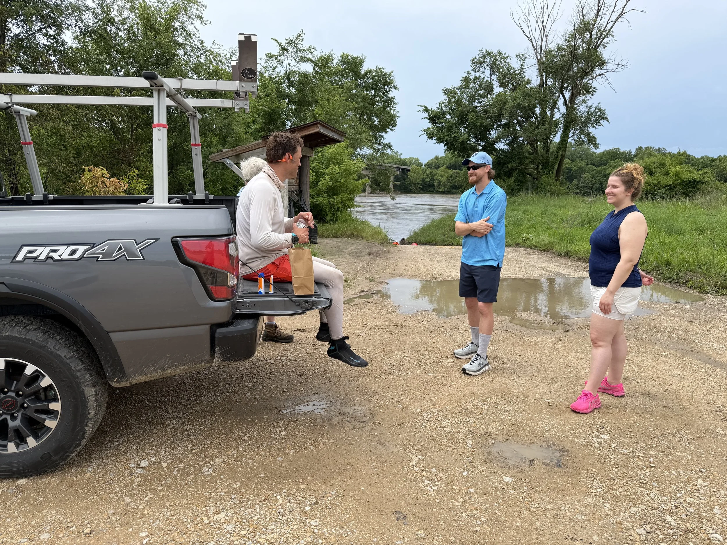
Finally reaching the Lecompton ramp, I was met by Ryan, who was going to head home for some sleep and Kellyn who was taking over crewing duties. My friend Tyler and his wife were also there along with Jim Guffey, who I had never met before but is a long time paddler and safety boat operator on the MR340, the upcoming Missouri River Speed Record attempt, and other ventures. A really cool guy with a ton of knowledge about the Kaw.
Finally, Kellyn had some macaroni and cheese, the first thing I’d eaten in the last day besides Uncrustables. Besides eating and replenishing fluids, there’s nothing more that I wanted to do at this ramp than stretch out as my body was getting pretty rigid from sitting in my kayak for so many hours. Quicker than not though, I was saying goodbyes and getting cheered on from everyone as I moved down the river once again.
The next 11 miles to Lawrence are my ‘home section’, the area of the river that I’ve paddled so many times that I have names for the resident nesting bald eagles etc. It was a bit emotional to see Bonnie and Clyde, one of the nesting pairs. I quickly passed one of my favorite Kaw River sandbars, that I named for Rowdy, a blind and deaf 15 year old dog that I rescued last February. Ahead was ‘3 mile sandbar’, a place I usually stop for a break after you guessed it, paddling 3 miles upriver from the north Lawrence boat ramp. I was reminded of early February this year and having to haul my kayak through the woods after getting blocked off from paddling due to an ice jam near the power plant, 2 miles up from the ramp. Thankfully the paddling was a lot easier than that day.
Passing the power plant and nearing the north Lawrence boat ramp, I saw a person wearing an orange shirt at the edge near the water and figured they were probably just fishing from the ramp like any usual day there. But this person’s actions seemed strange with some pacing up and down. At first, I had no idea but then as I got a bit closer, I said “no F’ing way” and sure enough my best friend Dillon Killoren was there. He lives in Texas but was helping guide a storm chasing tour and on their way back to Omaha, had made a detour to come see me after tracking me on RaceOwl. I had some tears welling up as I crossed the river and made my way towards the boat ramp. Upon greeting them and hopefully expressing my appreciation of the wonderful surprise, they told me to keep moving and he’d see me just less than a couple miles downriver. I didn’t disagree with that as the afternoon was quickly passing.
Those 1.7 miles passed quickly even though Lake Bowersock, the nickname given for the ponding area upriver of the Bowersock hydro dam where flow is reduced and a stiff headwind made it a bit tedious.
Arriving at the takeout for the Bowersock dam portage(1 of 2 mandatory portages for the Kaw), I happily saw Dillon once again along Kellyn. Thankfully we had practiced this portage and she brought me a portage dolly and it made it seem easy as I moved my kayak(probably weighing over 80lbs) up the steep side of the levee, 500 feet around the dam and back down the levee below the dam. She also brought a delicious sandwich that was such a welcome change of pace from the Uncrustables that I was finding hard to eat at this point. I wish I could’ve stayed and chatted more but it was time to get back on the water. https://kansasriver.org/river-access-map/river-mile-52-bowersock-dam/
Section 7:
Lawrence to DeSoto
After completing the Bowersock dam portage, I was really starting to feel fatigue but knew I just had to keep eating away at the journey one section at a time. On the lower side of the dam, the water was pretty rough due to higher flow and release turbulence from the dam. Fortunately, I was able to make it through this rough section still afloat and the water calmed after a few minutes as I passed by the lower Lawrence 8th Street ramp, a frequent starting place for training paddles to DeSoto and beyond.
The miles started melting away and I was trying to paddle without taking breaks even though every rare sandbar that I saw looked inviting. A few miles before Eudora, I was getting gassed and knew I had to stop across the river at a sandbar across from a privately owned boat ramp for at least a quick stretch. “Ahhhh…a few minutes to collect myself,” I thought. Just then at that moment, out of the corner of my eye a couple hundred yards downriver, I spotted a familiar figure and instantly recognized his clothes. He knew I was coming but I had no idea that he’d be there. My friend Nick Wastler was waving at me and had paddled a mile or two upriver to meet me and paddle together to Edwardsville. Son of a…I knew my break had just melted away but I was certainly looking forward to his humor and company on the water.
After putting on a back wrap that usually relieves some tension, we set off. What a relief it was to have someone to talk to though I can’t say I had that much to contribute to the conversation but I knew his mission was to keep me moving and I was so damn thankful for him to go out of his way to help out.
He sparked conversation and I tried my best to respond though my mental and physical strength was starting to wane by the hour. One of the funniest moments we had was a couple of miles before DeSoto with me hallucinating and thinking that I saw a group of deer ahead in the middle of the river. He actually agreed and said if I was hallucinating, that it was valid because he also saw the same thing. It actually just turned out to be probably a pile of junk barrels with some wood protruding from the top that looked like antlers.
We progressed to DeSoto, joking about the bad route I’d taken during the Kawlloween kayak race last fall as we were sprinting to the finish and how it would forever be burned into his mind of me running for a minute or two across a sandbar to try to beat him. No bad line taken this time or sandbar sprinting and we made it to the ramp with much more ease.
I don’t remember much about this ramp stop except refilling fluids, eating a bit and wondering how the heck I was going to do the next 31 miles. I was getting gassed more and more quickly. Ahead we went.
Section 8: 15 miles
DeSoto to Edwardsville
Back on the water even though I’d wanted a longer break, I knew the miles were going to suck no matter what, so I might as well “suffer faster”, as my friends Ryan and Laura Milby say. I was also hopeful that we could get to Edwardsville before dark to help prepare for the nighttime finishing miles that would be ahead after that.
By this point, I felt like I had a 25lb weight dragging behind my kayak. I was trying to paddle with good form and effort but I just couldn’t sustain it. Nick even said after the race that I was doing well before DeSoto but kinda dropped off a cliff after and him trying to converse to keep me distracted and out of my own head was mostly pointless at that time. All that said, I was still moving and we were making progress out of sheer determination. The first 5 miles to Cedar Creek mentally moved by quickly and the long northward section before the highway 7 bridge also zipped by. Hopefully I wasn’t sleeping while paddling but who knows.
In my head, I thought if we could just get to Edwardsville, the last section would be a breeze so that upped my determination. The only problem with this was that the last 3-4 miles to Edwardsville were paddled into one of the worst sections of headwinds of the whole journey, combined with another ‘lake’ effect from the backed up water of the Water One low head dam 1.8 miles downriver of Edwardsville that slowed down paddling pace considerably. Choppy water be damned, we forged on and finally made it to Edwardsville after a long slog.
Kellyn was demanding(rightfully so) that I needed to still drink and eat, even with only hopefully 3 hours left to go. It was actually still quite warm out but I started shivering and put on my rain jacket again, not a good sign since it was still nearly 80 degrees in the early evening. Some people at the boat ramp were really surprised how far I’d gone in the last day and change and it puts it into full perspective when you hear those views from outsiders who would never think of attempting such a trip, considering it probably borderline insane.
Section 9: 16 miles
Edwardsville to Kaw Point
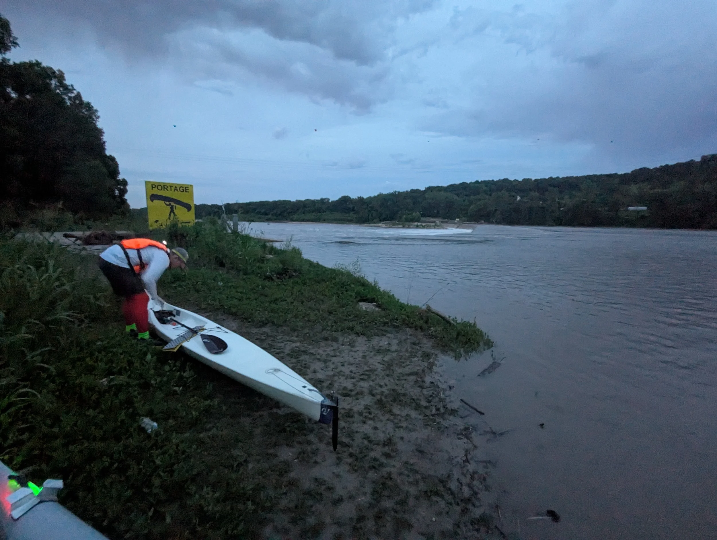
Nick’s daughter was picking him up at this ramp and Ryan had returned to join me for the last section to Kaw Point. He had gone home after Lecompton to get some rest and also prep his kayak for these night miles.
Getting back on the water, our first task at hand was to paddle 1.8mi downriver and portage around the WaterOne low water head dam just east I-435, the second mandatory portage required on the Kaw. The river left exit for the portage was fairly easy to navigate but the falls below the dam were really intimidating as you came right up to them before exiting.
https://kansasriver.org/river-access-map/waterone-dam/
This portage required no steep climb like Lawrence but the unstable ‘ankle breaker’ rocks made me a bit concerned about slipping and injuring myself, something that I wouldn’t allow to happen this close to the finish. I started by trying to carry my heavy kayak across the rocks but soon switched to dragging it to make myself more stable and we were able to make it back to the shore, amongst many people fishing below the falls.
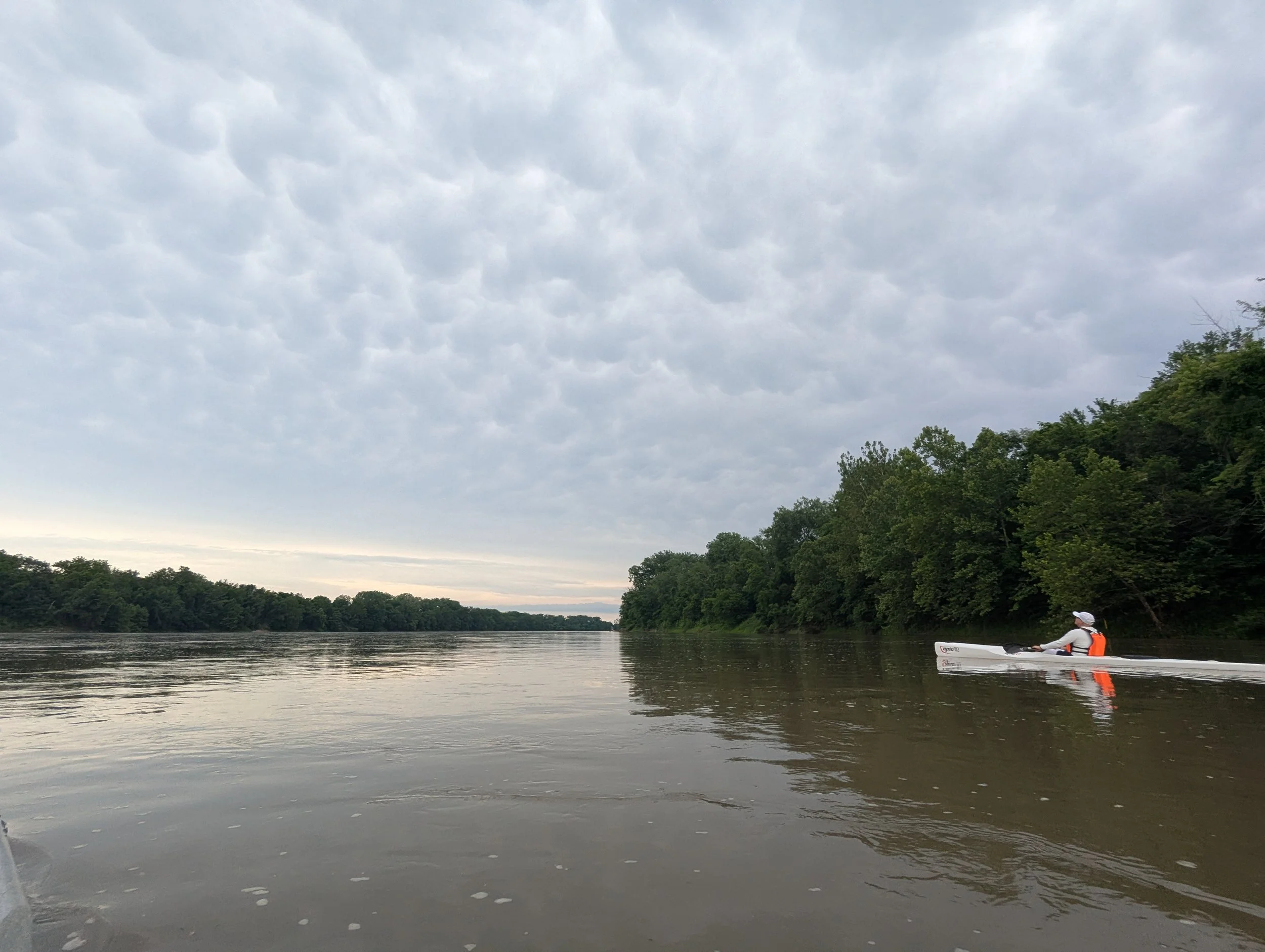
Getting back in the river, the initial water was pretty turbulent and lasted for a few minutes but then smoothed out as we took in the bright Kansas City skyline as dusk turned to dark. We encountered a few boats on the water, including one moving upriver that was particularly annoying. I’m not sure why but it was shining a spotlight from bank to bank, blinding us each time it switched.
More miles went by with casual conversation and observations about how this urban section of the river differs so much from the rest of the Kaw. Conversations were also pointed out about animals that the clouds looked like. I finally felt like I was beginning to relax more and the end was becoming almost a certainty with one major hurdle ahead that I was particularly worried about.
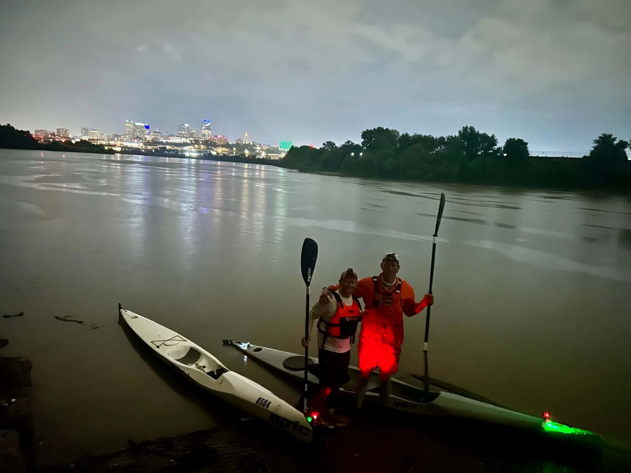
We began passing under the gauntlet of bridges that signal you’re getting close to downtown Kansas City but there was one bridge(or lack of) that I was pretty concerned about. The ‘final boss’ of the game, so to speak…the Highway 69 bridge is currently being reconstructed and has construction equipment in the river along with two big rock jetties that were put in place for the project. These jetties pinch the river that’s normally 500ft wide here into a narrow chute that seemed like 50ft wide, significantly increasing the speed that the river is flowing at through the narrow section. To compound this, there are also large metal pillars in the center of the flow combined with trying to paddle it at night made me pretty nervous in my depleted state. As we approached the opening and tried to pick our line, I was able to discern what both Dawn Buehler and Timothy Roy(thank you both) described as the route to pass through the section. We went for it and thankfully made it through but I did have quite the “oh shit” moment when the current tried to move me where I would’ve collided with one of the pillars but thankfully maneuvered out of the way and cleared it by a few feet. This is currently the most dangerous section of the river by far in my opinion until the construction of the bridge is complete.
The water downriver of the pinch point was very rough and squirrely as well, a whirlpool spinning me backwards at one point, but we progressed through it within a few minutes and were back in stable water and only 5 miles from the finish.
Taking a big north turn, downtown Kansas City came into view along with bridges like I-35 and I-70. One cool new addition to this section is the Rock Island bridge, an old railroad crossing, that was recently converted into a restaurant/development area. The people still around on the bridge at 11 something at night had to think the people paddling on the river were crazy.
Just a couple of miles left to go of easy paddling and we’d be there, I thought. Like a light switch being turned on though, the rain showers we noticed a bit earlier started producing lightning close by once again, a constant theme of the whole paddle. The Kaw would not let me finish easily, but at this point there are no sandbars and really nowhere to pull off…so there was no other option than tough it out. Making our way underneath several more bridges, we made a turn to the east and in a surreal state, the mouth of the Kaw where it merges with the Missouri River came into view. Before I knew it, we had hit the ramp in the rain with lightning still around and the paddle was over at 11:50pm. 31 hours and 50 minutes later after beginning at Junction City.
It was nice to be greeted by Kellyn and Timothy Roy at the ramp and having his help carrying the boats up and back to the truck. You would think that there would be a grand celebration but through the fatigue of the last day, I think everyone was ready to hit the road and get some sleep and we soon did that.
Mission accomplished and I am thankful for safe passage on an absolutely wonderful river.
Acknowledgements:
I knew that in attempting this FKP attempt of the Kaw, that there was a decent chance I would break the existing record Ryan McCoy set in the spring of 2025. I knew and could tell Ryan’s fastest known paddle meant a lot to him. Yet, Ryan encouraged me to try it, never withheld any knowledge and was an open book about any questions I asked. He is a wonderful steward of the Kaw and a huge reason why I was able to finish. Thank you, Ryan. You have my word that I will do everything I can to help the next person who attempts a fastest known paddle attempt of this river just as much as you helped me before and throughout this journey.
Thank you Kellyn for always being by my side. You sacrifice so much time shuttling me to and from different training runs, dealing with ground crew support, and putting up with paddling shenanigans in general. My achievements are your achievements and I am so thankful for you.
Thank you Nick for paddling those 25 miles with me. Your humor and company meant a lot during that stretch of difficult miles.
Friends and supporters, thank you for showing up to boat ramps and all of your support online and elsewhere!
Friends of the Kaw - this wonderful organization has done so much work for the advancement of paddling on the Kansas River and paddling the 173 miles wouldn’t be possible without their collective efforts and resources they’ve put together. https://kansasriver.org/
Fastest Known Paddle - I wouldn’t have probably thought of doing an FKP attempt of the Kaw if it wasn’t for the organizers of this website creating and managing it like they have. Thank you.
Thank you Jon Marble with RaceOwl.com, the website who provided the live tracking for my Kaw FKP attempt. If you enjoyed following along in real time, please consider buying Jon a cup of coffee on the RaceOwl website.
Trip Details
GPX Files
GPX Recording Devices
Garmin Fenix 5x watch
Garmin Etrex 30x
Strava via phone
Photos and Videos by Ramp
Junction City Kansas River Access (RM173) to Kaw Point River Access (RM 0)
Boat: Epic V7
Paddles: Epic Club Carbon Small Mid-Wing 210-220cm
Start Time: 4:00:00pm May 29, 2026
End Time: 11:50:05pm May 30, 2026
Break Durations:
5/29
08:21pm-8:32pm - Manhattan/K177 Access (39.174740, -96.553590)
11:44pm-11:55pm - Wamego Access (39.198000, -96.305010)
5/30
2:10am-2:21am - St. Marys (39.180045, -96.109711)
5:06am-5:14am - Pre-Topeka stop (39.065684, -95.839300)
6:00am-7:30am - Kaw River State Park (39.068892, -95.753464)
9:10am-9:20am - Seward Access (39.060250, -95.594170)
11:33am-11:55am - Perry/Lecompton Rising Sun Access (39.050290, -95.387730)
1:59pm-2:18pm - Lawrence Bowersock Access (38.976300, -95.234680)
3:49pm-3:54pm - 1 mile from Eudora (38.957637, -95.102283)
5:47pm-5:58pm - DeSoto Access (38.985070, -94.974050)
8:24pm-8:35pm - Edwardsville Access (39.050730, -94.816860)
Portage Locations
1:59pm-2:18pm - Lawrence Bowersock Portage (38.976840, -95.236390) (Kellyn Young and Dillon Killoren witnessed)
9:00pm-9:11pm 12 - WaterOne Weir Portage (39.047250, -94.787940) (Ryan McCoy witnessed)
Total Distance - 173 Rivermiles (173-175mi depending on different GPS units)
Trip Report (Technical)
Weather
Mid 80s during the day and mid 60s at night with scattered thunderstorms throughout.
Water Levels:
Milford Reservoir: releasing 50 cfs
Junction City RM 173 - About 610 cfs
Manhattan RM149 - About 600 cfs
Tuttle Creek Reservoir releasing about 5000 cfs down Big Blue River
Wamego RM128 - About 6100 cfs
Topeka RM87 - About 9200 cfs
Perry Lake Reservoir releasing about 500 cfs down Delaware River
Perry/Lecompton RM64 - About 10,600cfs
Clinton Lake Reservoir releasing about 21 cfs down Wakarusa River
DeSoto RM31: About 10,000 cfs
Near I435 Bridge RM 15: About 11,000 cfs