lamine river, mo Overall FKP Details
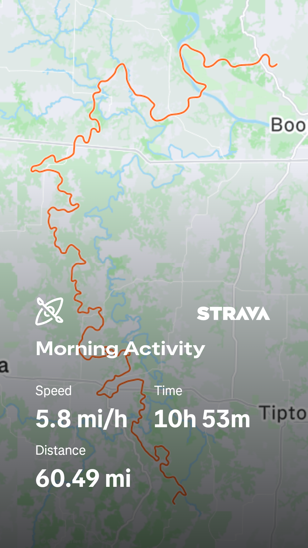
CLaMine River Overall Fastest Known Paddle: 10H, 53M
(this is also the 1st place solo male FKP)
Matt “Mud” Britt age 55, Glasgow, MO)
May 31, 2026
60 miles
Unupported
Start: Confluence of Flat and Richland Creek. Otterville, MO 6:22am, May 31, 2026
Finish: De Bourgmont boat ramp. Lamine, MO. 5:15pm, May 31, 2026
Support Crew:
Map resources:
Boat: Epic V7
Tracking: Strava app
Route Description from Mud: There is a public parking lot 3/10ths mile to the east (on Richland Creek) from the start point. At the 1.8 miles point the river splits, although the river right route is shorter, it isn't accessible during lower flows. I am proposing to use the river left route. At the 3.5 mile poit there is an old grist mill weird that shows in times of average to low flows. It will damage carbon boats. It's undetectable during high flows. The rest of the watercourse is pools and riffles and not maintained for navigation. The actual distance is 60.5 miles, but the form didn't like the decimal.
Full Trip Report from Matt “Mud” Britt
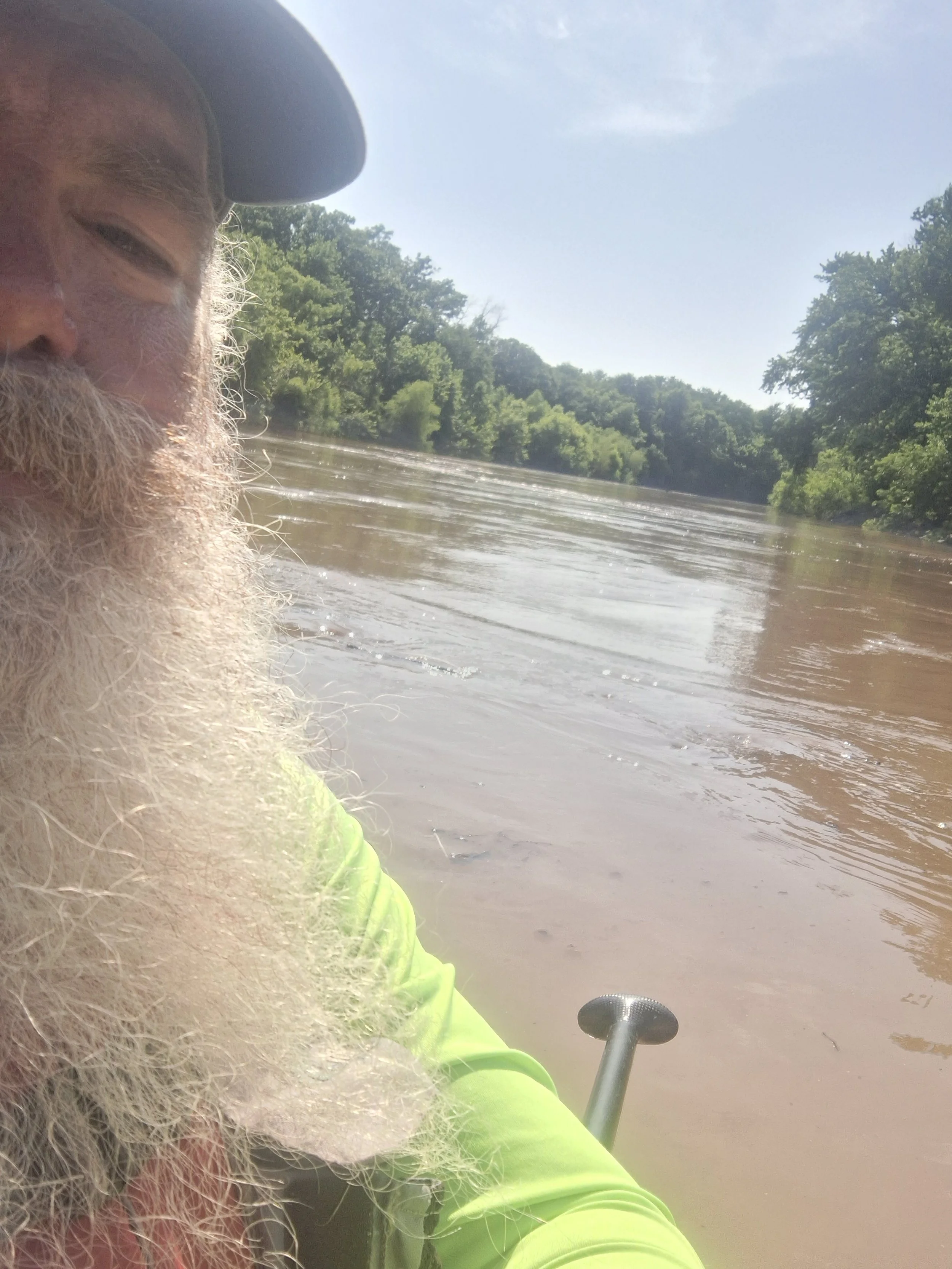
The river was at a nice floatable level the night before the run and the forcast showed another rainshower overnight. When I woke up (0415) I found the overnight rain didn't occur, so I had to change up my plan. I brought my Epic V7 (Roxie)instead of my carbon Think ski(Mishipeshu) I also left early because I knew the water would be lower than I hoped and I might be needing as much daylight as I could get.I put on at the public parkinglot in the Lamine River Conservation Area beside Richland Creek.It was a quick quarter mile to the confluence with Flat Creek where the Lamine River officially starts. The river gauge is about 6.3 miles down the river from the start point. The gauge was at 3.24 when I started. Within a few hours of paddling, a heavy rainshower occured. It didn't seem to affect the ditches flowing in. At about the 4 hour mark a very heavy rainshower occured and the side ditches showed the influx of runoff. There were two class II rapids along the route. One was at the grist mill site (@3.45Mi), the other was about 1/3 of a mile past 135hwy. The river slowly rose a little more than a foot (at the gauge) while I was paddleing, but the heavy rain affected thing in different ways. About the half way point it slows down in longer pools with less riffles. Around 20 miles from the finish the river started to have a lake effect and slow way down. I figuered it was from inflow from the Blackwater River, but after a few miles I found that it was inflow from Heath's Creek. It was flowing very strong and filling the Lamine with logs. From there the water was more swift and I made good time afterwords. I met Michelle at Robert's Bluff and got hug and dropped off the gear I wouldn't need, and 2 liters of extra water I ended up not using. That lightend me up a little afterword, and I managed to paddle to the front of the log flow coming from Heath's Creek. I rode the push from that surge of water for several more miles and made great time. I used a 48" carbon single blade paddle and took Hammer Perpetuem as my nutrition. I didn't take but one picture 9mouth of the Blackwater River). The camera on the front of my phone has a broken lense.That was a lovely adventure, and I left a huge amount of room for someone to beat my time. Good luck!!