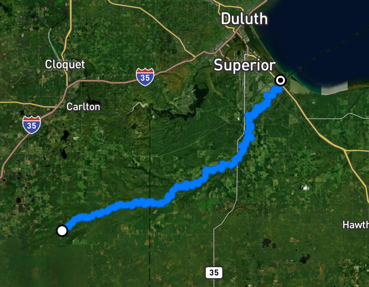
nemadji river, mn/wi Overall FKP Details


Nemadji River Overall Fastest Known Paddle: 10 hours, 6 minutes, 27 seconds
Joe Gerard, 47, of Duluth, on 4/30/26
54 miles
Unsupported
Start: Carlton County Rd 103 bridge Clear Creek Township, MN.6:56am on 4/30/26
Finish: Mouth of Nemadji River. Superior, WI.5:02pm on 4/30/26
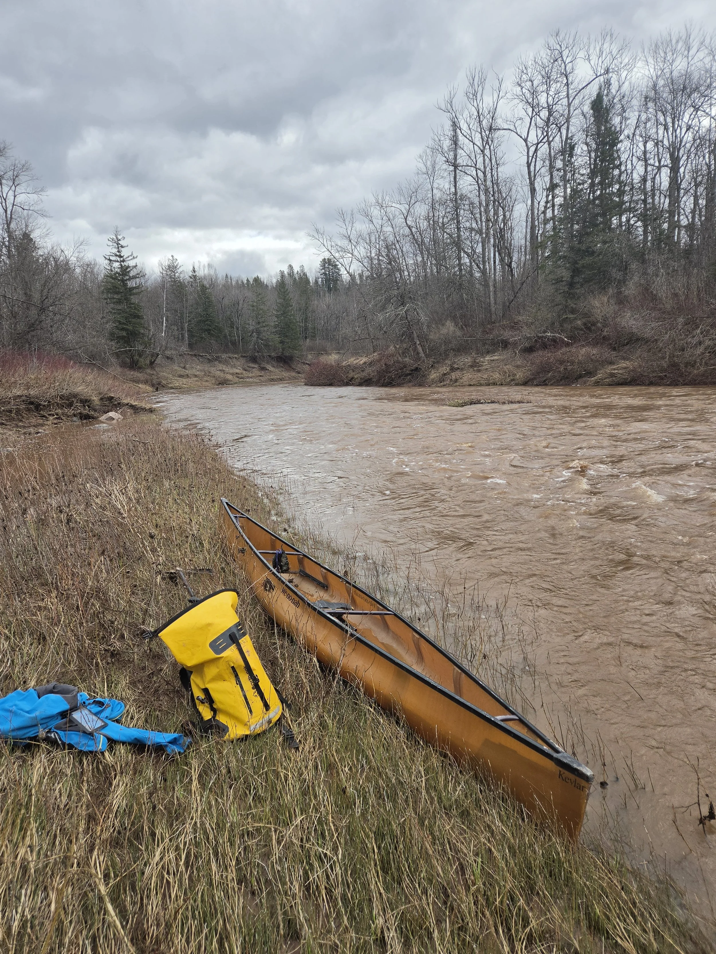
Boat: Wenonah Advantage Canoe
About Joe:
My name is Joe Gerard, I am a husband and father in Duluth, MN. I learned to paddle canoes from my dad as a kid in the Twin Cities, MN. I spent some of my teenage years canoe racing in Minnesota but did not keep with the sport. Over the last 5 years I have regained an interest in adventurous paddling and this will be my first attempt at recording a fastest known paddle route.
Trip Report:
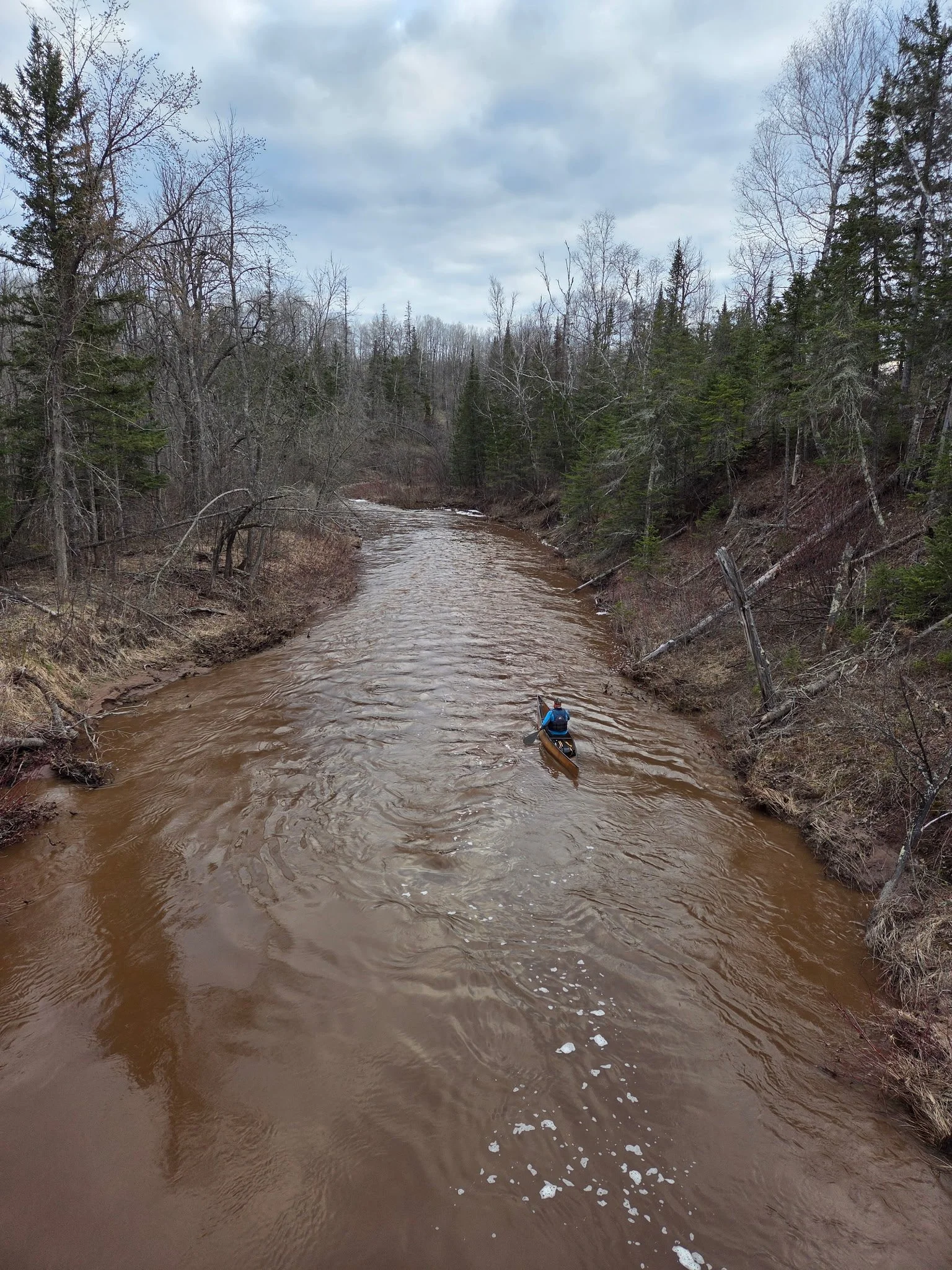
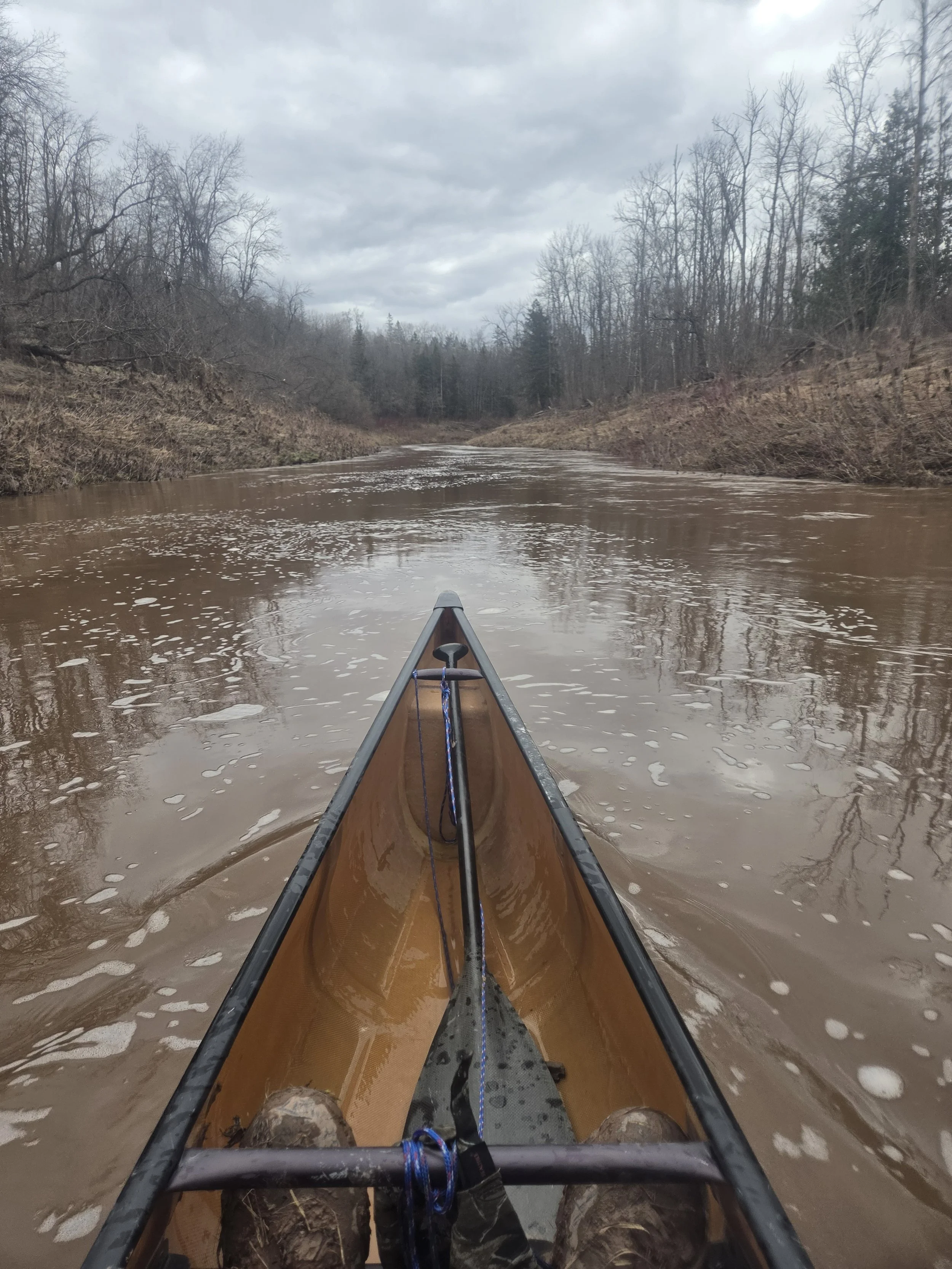
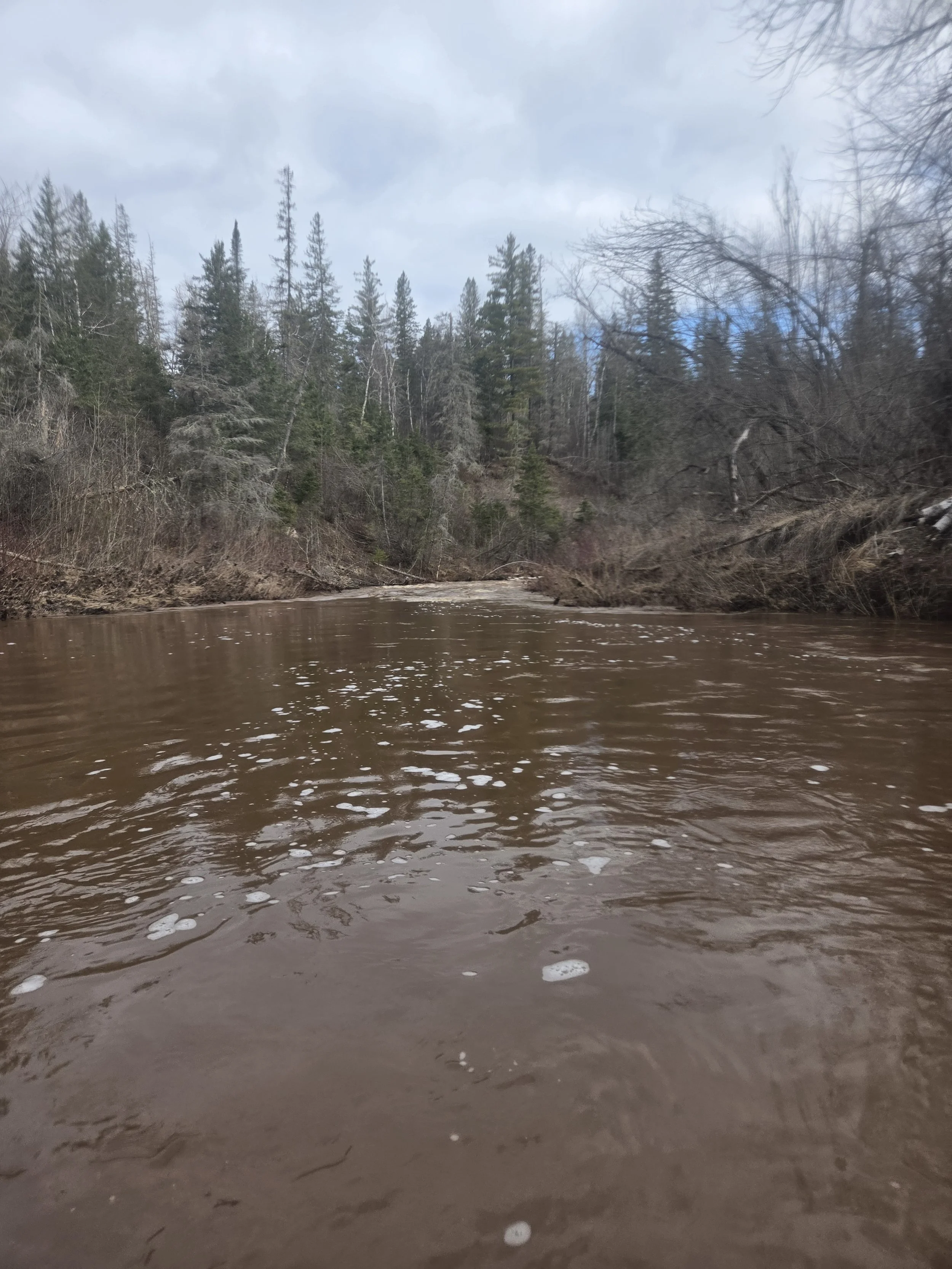
The Nemadji River flows through steep valleys of unstable clay. As a result, the water runs an opaque, brown color, resembling chocolate milk. I pushed off from the Hwy 103 bridge at 6:56 AM on April 30, 2026. The air temp was 31 degrees F. I was paddling a Wenonah Advantage canoe,and used a single bladed paddle. The narrow upper section of the river was difficult to maneuver, with lots of tight corners, overhanging trees, and constant small rapids. I don't think anything would rise much above class 1, but with the high water, there was a fair bit of challenge to them in my tippy canoe. There was one log jam at about mile 3 that I had to portage around. In all the turbulent water, I was constantly digging hard to keep the canoe from getting spun around by weird currents bouncing off obstacles and shoreline features around every bend. By mile 8, I was beginning to experience cramping in my arm muscles. I had only canoed a few times this spring, so following the long winter without any paddling, it wasn't surprising that I had a few issues. At the 10 mile point, I entered a larger rapid with haystacks and encountered a strong side current. I lost my balance and rolled the canoe. I expected the water to be waist deep at most, and was surprised to find myself neck deep and swimming instead of wading to shore. This whole river has steep banks with slippery muddy walls, and there aren't many places suitable to climb out. But lucky for me, there was a perfect gravel bar at the end of this rapid where I was able to drain the canoe and put my belongings back inside. I had extra clothes in a dry bag, but didn't change at the moment because I had a surge of adrenaline and thought I could air dry as I paddled. I paddled hard to stay warm and finished the last bit of warm coffee that I had in my thermos.
I wasn't confident that it would be my last swim, so I wanted to get past the largest rapid on the route, which would probably be considered class 2, before changing into new clothes. After an hour, I noticed that I began to start getting chilled. The hard paddling wasn't enough to keep my body warm with the wet clothing. I started getting more cramps, even in my legs and back. I began having negative thoughts about calling it a day at the next access. I decided to find somewhere to get out and change. Just in time, I rounded a bend and found that last big rapid I was worried about, navigated it safely, and then pulled off to warm up. As I was changing in the 35 degree F air, I suddenly got very cold, very quickly. I had brought 2 sets of extra clothes and another jacket. I put them on and instantly began warming up. I even put on a second hat on top of the first one. I ate some food and drank cold energy drink, hoping the electrolytes would help with the cramps. I jumped around a bit to get the blood flowing to my legs, and once I was heating up adequately, I set off. It only took 15 minutes or so to get warm enough to need to shed a layer. That was nice, and reassuring, so I decided I was going to continue the trip at that point. Another 5 miles of small rapids and I was finally done with the rapids for this river. Easy rapids are usually the highlight my river trips, but the fear of getting wet and cold again made me glad to be past them.
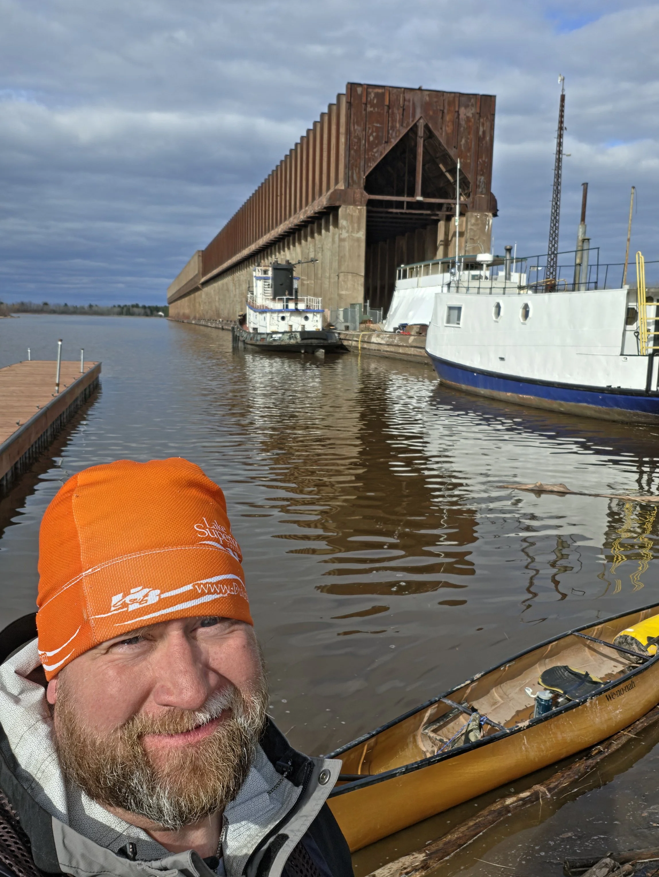
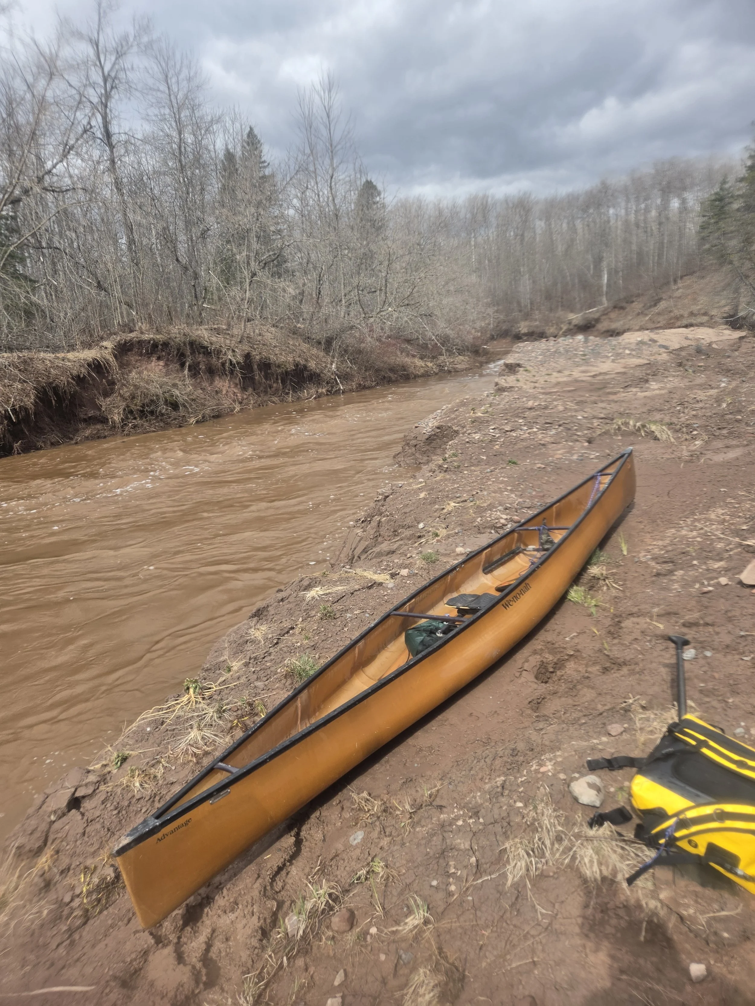
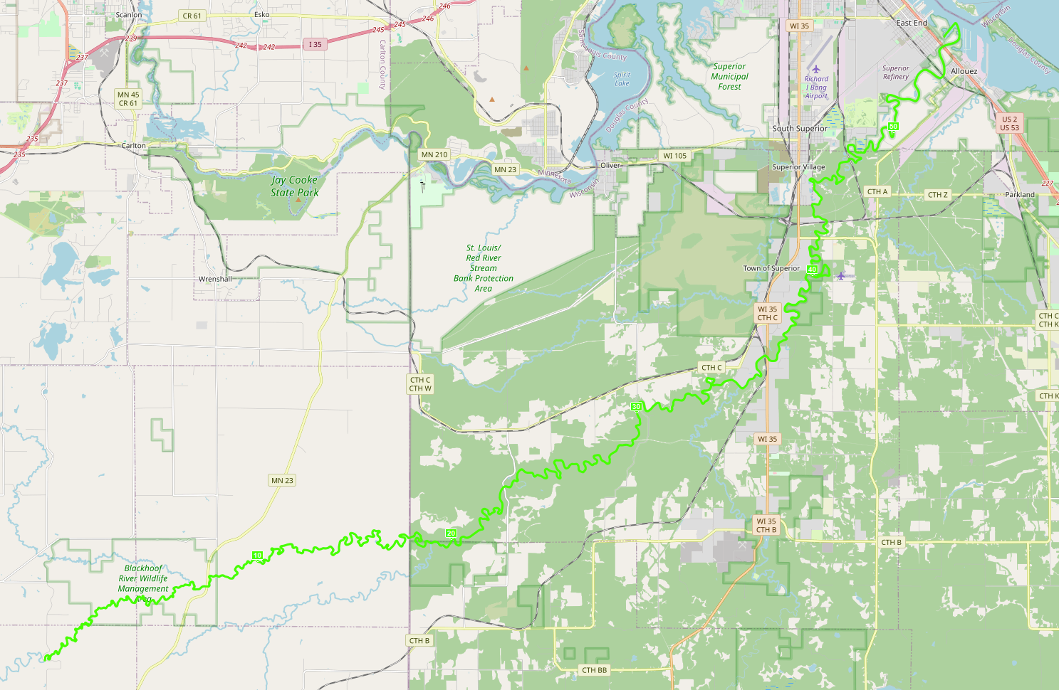
The next 10 miles of this river are very unique. I call it the conveyor belt. The river narrows from about 80 feet wide, down to about 40 feet. The whole river moves fast without many eddies or obstacles. It runs in near vertical banks and the current really flows quickly. I was still getting pushed around from all the current bouncing off the banks, but I was cruising through that area. The cramping was an always present problem, but not nearly as bad as when I was cold. After the Black River entered and passing the Hwy 35 Bridge, the river calmed down a little bit. It gets wider again, and goes under several train bridges and the Hwy C bridge and stream gauge station. By this point, I was getting very exhausted. I knew I had a few hours left, and I kept doing mileage calculations in my head, hoping to get shorter and shorter distances to go. But alas, for about an hour it seemed all my math kept telling me 10 or 11 miles left. The shoreline continued to pass so quickly I couldn't believe I still had 2 hours to go, but sadly, it was true. I was starting to really fall apart, so I decided to get out and get the rest of my sandwich out of my pack. It was such sweet relief to stand up and stretch my legs. The infusion of new calories was just what I needed to make the final push. The last 5 miles of the river meanders and has a few big, straightaways. I was beginning to encounter headwinds too, just what I didn't want with the slowing current. The first 50 miles of this river are very remote and wild. Except for one at the start, I didn't see another house or cabin to be until mile 45. Then, at mile 50, I rounded a bend and saw the giant oil tanks and power lines of the Superior oil refinery. It was smelly too. At last, at mile 52, I could catch glimpses of the tall ore docks that reach out into Allouez Bay - and the end of this trip. Paddling under the Hwy 2 bridge, I was so relieved to finally be reaching the outlet of the Nemadji. The ore docks are for loading ships with iron ore pellets for shipment to steel mills down the Great Lakes. The ore dock pictured, on the right, at the mouth of the river is the one where the Edmund Fitzgerald loaded for the last time, before sinking in Lake Superior. I exited the river and paddled in the bay around the Loon's Foot ore dock to get to the Loon's Foot Landing. I was so tired that on the quarter of a mile finishing stretch, with the end in sight, I felt like I could somehow fail to reach it. But, at 5:02pm, I stepped onto the landing and stopped my watch. It read: 10H 06M 27S. I could barely stand up and stretch my body. I was completely spent, and so happy that I made it safely.
Bridge Splits:
Carlton County Hwy 103 Start: 0:00:00
MN Hwy 23: 1:32:00
West County Rd W: 4:33:19
South Dedham Rd: 5:34:00
Finn Rd: 6:17:27
WI Hwy 35: 6:36:30
County Road C: 7:39:29
Bardon Avenue: 8:56:32
US Hwy 2: 9:48:41
Osaugie Trail Bridge: 9:50:36
Loon's Foot Landing: 10:06:27
River Level at Hwy 23 in Pleasant Valley, MN was 506 cfs on the morning of 4/30/26.